National Geographic
Washington State Wall Map - Standard (40.5" x 30")
Washington State Wall Map - Standard (40.5" x 30")
Couldn't load pickup availability
National Geographic Washington State Wall Map — Standard, 40.5" x 30". Physical and political detail. Rolled.
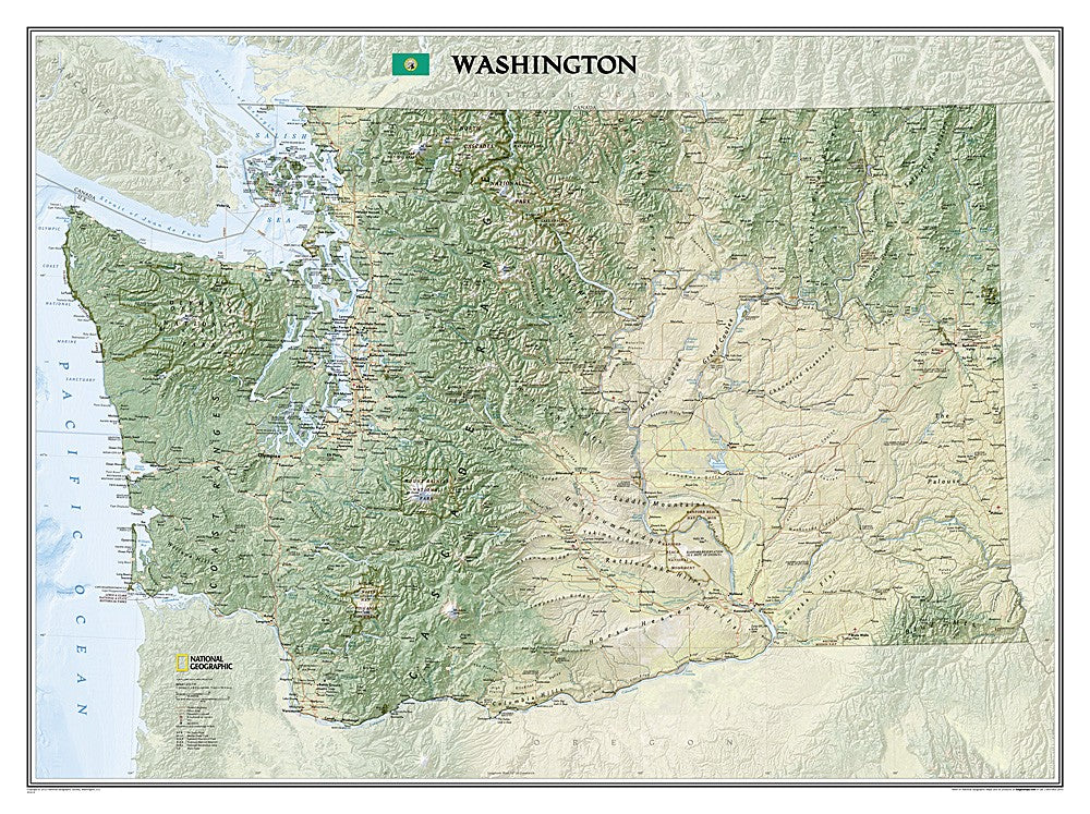
The Washington State Wall Map covers the full state with rich physical and political detail — the Olympic Peninsula's rainforests, Cascade Range volcanoes (Rainier, Baker, St. Helens, Adams), Columbia Plateau, Puget Sound, and major cities, highways, national parks, and wilderness areas. National Geographic's renowned cartographic detail in a large format ideal for wall display.
Key specs
- SKU: NGWM031
- Size: 40.5" x 30"
- Format: Standard (rolled)
- Material: High-quality paper print
- Coverage: Full state of Washington
Why it works
At 40.5" x 30", this map shows Washington's full geographic diversity in readable detail — from the Pacific coast to the Cascades to the arid eastern plateau. The standard rolled format is the economical option for buyers who don't need tube protection or lamination. The large format makes it useful for trip planning across the state and striking as wall decor.
Ideal for
Trip planning, home or office display, classrooms, and as a gift for Washington residents, visitors, and outdoor enthusiasts. See also the Tubed (NGWM032) and Laminated (NGWM033) editions.
Share