National Geographic
Telluride Silverton Ouray CO Waterproof Topo Map Hiking Camping Trail #141
Telluride Silverton Ouray CO Waterproof Topo Map Hiking Camping Trail #141
Couldn't load pickup availability
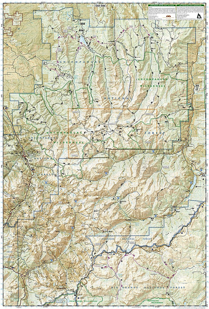
National Geographic Trails Illustrated Telluride, Silverton & Ouray Map #141 — waterproof, tear-resistant, scale 1:63,360. Coverage of the San Juan Mountains including Mount Sneffels Wilderness, Uncompahgre National Forest, Red Mountain Pass, and the Million Dollar Highway corridor. GPS-compatible.
The National Geographic Trails Illustrated Telluride, Silverton & Ouray Map covers the heart of Colorado's San Juan Mountains — the Mount Sneffels Wilderness, Uncompahgre National Forest, Bridal Veil Falls, Red Mountain Pass, the Million Dollar Highway (US 550), and surrounding 14er terrain. Trails, 14er routes, OHV routes, campgrounds, trailheads, and GPS coordinates are mapped in detail.
Key specs
- SKU: NGTI141
- Map number: 141
- Scale: 1:63,360
- Coverage: Telluride, Silverton & Ouray area, Colorado (San Juan Mountains)
- Material: Waterproof, tear-resistant paper
- Features: Trails, Mount Sneffels Wilderness, 14er routes, OHV routes, Million Dollar Highway, campgrounds, GPS coordinates
Why it works
The Telluride-Silverton-Ouray triangle is one of the most spectacular mountain landscapes in Colorado, with 14ers, waterfalls, historic mining towns, and the iconic Million Dollar Highway all concentrated in a single map area. The Mount Sneffels Wilderness and surrounding 14ers require detailed topographic mapping for safe route-finding on the technical terrain. Waterproof construction survives the San Juan Mountains' frequent afternoon thunderstorms and the variable conditions on high-altitude OHV routes.
Ideal for
Hikers, mountaineers, OHV riders, and outdoor enthusiasts exploring the Telluride, Silverton, and Ouray area of the San Juan Mountains. See also NGTI140 (Weminuche Wilderness) for adjacent wilderness coverage to the east.
Share