National Geographic
Telluride Local Trails: Map #603
Telluride Local Trails: Map #603
Couldn't load pickup availability
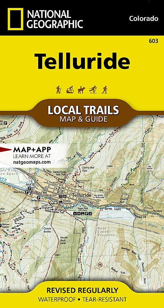
National Geographic Trails Illustrated Telluride Local Trails Map #603 — waterproof, tear-resistant, scale 1:31,680. Topographic trail map of the Telluride area with 7 featured trails, trailheads, parking, difficulty ratings, and elevation profiles. GPS-compatible.
The National Geographic Trails Illustrated Telluride Local Trails Map covers the trail network surrounding Telluride, Colorado in the San Juan Mountains. The front side provides a topographic trail map at 1:31,680 scale; the reverse features 7 handpicked trails — from the 1.6-mile Ridge Trail to the challenging Liberty Bell Basin — each with descriptions, mileage, elevation gain, and profiles. Trailheads, parking areas, and GPS coordinates are mapped in detail.
Key specs
- SKU: NGTI603
- Map number: 603
- Scale: 1:31,680
- Folded size: 4" x 7.5"
- Flat size: 19.5" x 26.25"
- Coverage: Telluride local trail network, Colorado (San Juan Mountains)
- Material: Waterproof, tear-resistant paper
- Features: 7 featured trails with elevation profiles, trailheads, parking, difficulty ratings, GPS coordinates
Why it works
Telluride's trail network climbs from the town box canyon floor to high alpine basins and ridges in the San Juan Mountains — the dramatic elevation gain and complex terrain make a detailed local trails map with elevation profiles essential for planning hikes appropriate for your fitness level and acclimatization. The 7 featured trails with descriptions and profiles make this map a practical guide as well as a navigation tool. Waterproof construction survives the San Juan Mountains' frequent afternoon thunderstorms.
Ideal for
Hikers, mountain bikers, and outdoor enthusiasts exploring the trail network around Telluride in the San Juan Mountains. See also NGTI141 (Telluride, Silverton, Ouray) for broader topographic coverage of the region.
Share