National Geographic
Tahoe Rim Trail: Map Guide #1013
Tahoe Rim Trail: Map Guide #1013
Couldn't load pickup availability
National Geographic Trails Illustrated Tahoe Rim Trail Map Guide #1013 — waterproof, tear-resistant. Complete coverage of the 165-mile Tahoe Rim Trail circumnavigating Lake Tahoe across California and Nevada. GPS-compatible.
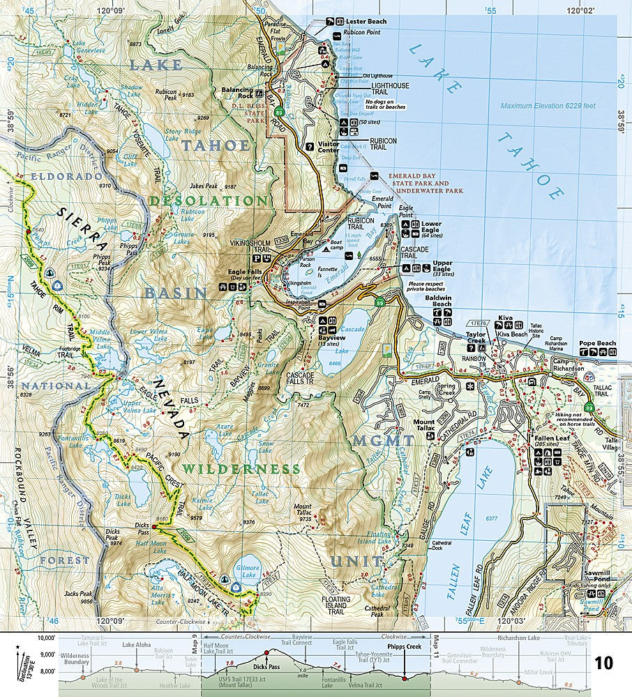
The National Geographic Trails Illustrated Tahoe Rim Trail Map Guide covers the complete 165-mile TRT loop circumnavigating Lake Tahoe across California and Nevada. Trail segments, trailheads, campsites, water sources, resupply points, and the Desolation Wilderness and Mount Rose Wilderness sections are mapped in detail.
Key specs
- SKU: NGTI1013
- Map number: 1013
- Coverage: Tahoe Rim Trail (complete 165-mile loop, CA/NV)
- Material: Waterproof, tear-resistant paper
- Features: Complete TRT route, trailheads, campsites, water sources, wilderness sections, GPS coordinates
Why it works
The Tahoe Rim Trail's 165-mile loop crosses two states and multiple wilderness areas — a single dedicated map covering the complete route with campsite and water source detail is far more practical than managing multiple individual maps for different sections. The TRT shares miles with the Pacific Crest Trail through the Desolation Wilderness, making accurate trail junction detail essential. Waterproof construction survives the afternoon thunderstorms common around Lake Tahoe in summer.
Ideal for
Thru-hikers, section hikers, and backpackers completing the Tahoe Rim Trail. See also NGTI802 (Desolation, Granite Chief Wilderness) and NGTI803 (Lake Tahoe Basin) for individual section coverage.
Share