National Geographic
Superior National Forest West: Map #753
Superior National Forest West: Map #753
Couldn't load pickup availability
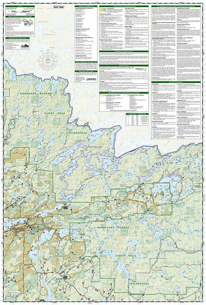
National Geographic Trails Illustrated Superior National Forest West Map #753 — waterproof, tear-resistant. Coverage of the western Superior National Forest including the Boundary Waters Canoe Area Wilderness (BWCAW) western entry points in Minnesota. GPS-compatible.
The National Geographic Trails Illustrated Superior National Forest West Map covers the western portion of the Superior National Forest and the western BWCAW entry points in northeastern Minnesota. Canoe routes, portages, campsites, lake access, and surrounding forest trails are mapped in detail with GPS coordinates.
Key specs
- SKU: NGTI753
- Map number: 753
- Coverage: Superior National Forest West & western BWCAW, Minnesota
- Material: Waterproof, tear-resistant paper
- Features: Canoe routes, portages, BWCAW campsites, lake access, trails, GPS coordinates
Why it works
The BWCAW's complex network of lakes, portages, and canoe routes requires detailed mapping that covers both the water routes and the portage trails connecting them — a map that shows both at sufficient scale is essential for planning multi-day canoe trips. The western entry points serve some of the most popular BWCAW routes, making accurate portage and campsite detail critical for trip planning. Waterproof construction is essential for canoe use where maps are constantly exposed to water.
Ideal for
Canoeists, kayakers, anglers, and backpackers exploring the western BWCAW and Superior National Forest in Minnesota. See also NGTI752 (East Superior National Forest) for the eastern section coverage.
Share