National Geographic
State Bridge & Burns: Map #120
State Bridge & Burns: Map #120
Couldn't load pickup availability
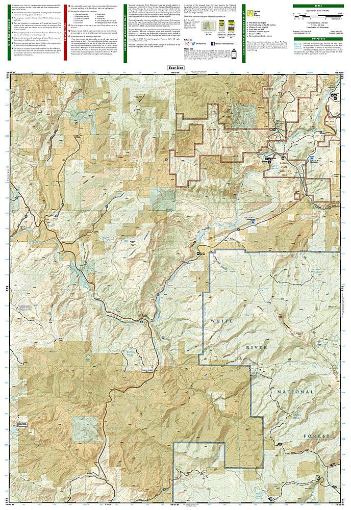
National Geographic Trails Illustrated State Bridge & Burns Map #120 — waterproof, tear-resistant, scale 1:63,360. Coverage of the Colorado River corridor, State Bridge, Burns, and surrounding White River National Forest. GPS-compatible.
The National Geographic Trails Illustrated State Bridge & Burns Map covers the Colorado River corridor west of Kremmling, the State Bridge area, Burns, and surrounding White River National Forest lands in northwest Colorado. Trails, OHV routes, river access points, trailheads, and GPS coordinates are mapped in detail.
Key specs
- SKU: NGTI120
- Map number: 120
- Scale: 1:63,360
- Coverage: State Bridge & Burns area, Colorado (Colorado River corridor)
- Material: Waterproof, tear-resistant paper
- Features: Trails, OHV routes, Colorado River access, trailheads, GPS coordinates
Why it works
The State Bridge and Burns area covers a section of the Colorado River corridor that's popular for rafting, fishing, and OHV riding but lacks the detailed mapping that more famous Colorado destinations receive. The mix of river access points, forest roads, and OHV trails requires a map that covers all uses in one sheet. Waterproof construction survives river use and the variable weather common in northwest Colorado.
Ideal for
Hikers, OHV riders, anglers, and rafters exploring the Colorado River corridor and White River National Forest around State Bridge and Burns. See also NGTI119 (Yampa, Gore Pass) and NGTI121 (Eagle, Avon) for adjacent coverage.
Share