National Geographic
St John Virgin Islands USVI Waterproof Map Hiking Snorkeling Beach Trail #236
St John Virgin Islands USVI Waterproof Map Hiking Snorkeling Beach Trail #236
Couldn't load pickup availability
National Geographic Trails Illustrated St. John Virgin Islands Map #236 — waterproof, tear-resistant. Coverage of St. John, U.S. Virgin Islands National Park including hiking trails, snorkeling sites, beaches, and marine areas. GPS-compatible.
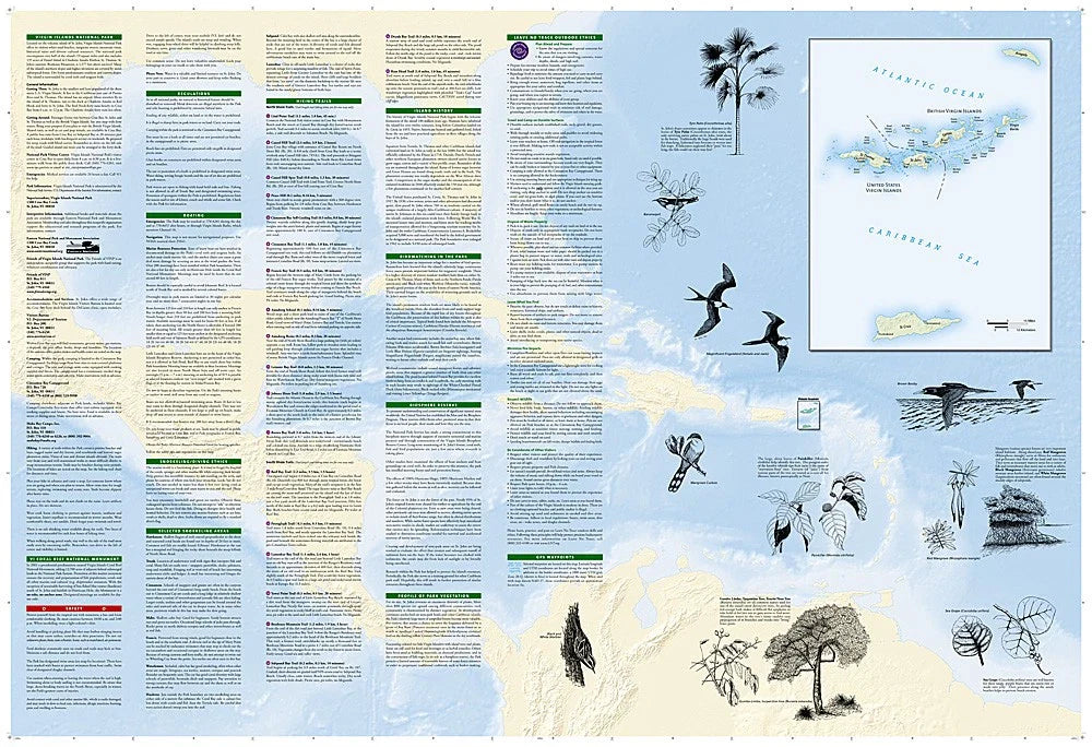
The National Geographic Trails Illustrated St. John Virgin Islands Map covers the full island of St. John and Virgin Islands National Park — hiking trails, snorkeling sites, beaches, Trunk Bay, Cinnamon Bay, the Reef Bay Trail, and surrounding marine areas. Trail routes, beach access, snorkeling locations, and GPS coordinates are mapped in detail.
Key specs
- SKU: NGTI236
- Map number: 236
- Coverage: St. John, U.S. Virgin Islands National Park
- Material: Waterproof, tear-resistant paper
- Features: Hiking trails, snorkeling sites, beaches, marine areas, Reef Bay Trail, GPS coordinates
Why it works
St. John's combination of hiking trails through tropical forest and world-class snorkeling reefs requires a map that covers both land and marine environments — the snorkeling site locations and beach access points are as important as the trail network for most visitors. The Reef Bay Trail's petroglyphs and the island's historic sugar plantation ruins add cultural points of interest that require accurate location detail. Waterproof construction is essential in a tropical marine environment where salt spray and rain are constant.
Ideal for
Hikers, snorkelers, beachgoers, and nature lovers exploring St. John and Virgin Islands National Park in the U.S. Virgin Islands. See also NGTI790 (El Yunque National Forest) for nearby Caribbean coverage.
Share