National Geographic
South Platte River, Middle Fork: Map & Guide
South Platte River, Middle Fork: Map & Guide
Couldn't load pickup availability
Waterproof fishing and river recreation map of the South Platte River Middle Fork — topography, access points, fishing sites, trails, and public lands.
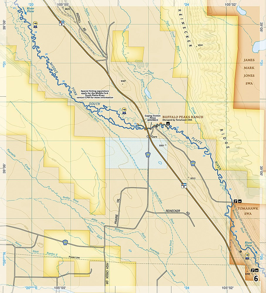
The National Geographic Fishing & River Map 2301 covers the South Platte River Middle Fork corridor through Pike National Forest, including campgrounds, fishing access points, boat launches, trails, and public land boundaries. Detailed topography with contour lines and shaded relief on waterproof, tear-resistant paper with a full UTM grid for GPS navigation.
Coverage includes:
- South Platte River Middle Fork corridor
- Pike National Forest and surrounding public lands
- Major trails, backroads, and recreation sites
- Campgrounds, picnic areas, fishing access points, and boat launches
- Elevation contours and shaded relief
Key specs:
- SKU: NGFR2301
- Scale: 1" = ½ mile
- Folded size: 4.25" x 9.38"
- Material: Waterproof, tear-resistant paper with stainless steel staples
- Full UTM grid for GPS navigation
- Weight: ~3.2 oz
Why it works:
The South Platte Middle Fork runs through some of Colorado's most productive and accessible fishing water in Pike National Forest. This map covers the full corridor with the access point, trail, and terrain detail needed for planning fishing trips, float trips, and camping along this stretch of the river.
Ideal for: Anglers, kayakers, campers, and hikers exploring the South Platte River Middle Fork and Pike National Forest. See also NGFR2302 for the Elevenmile-Chatfield section.
Share