National Geographic
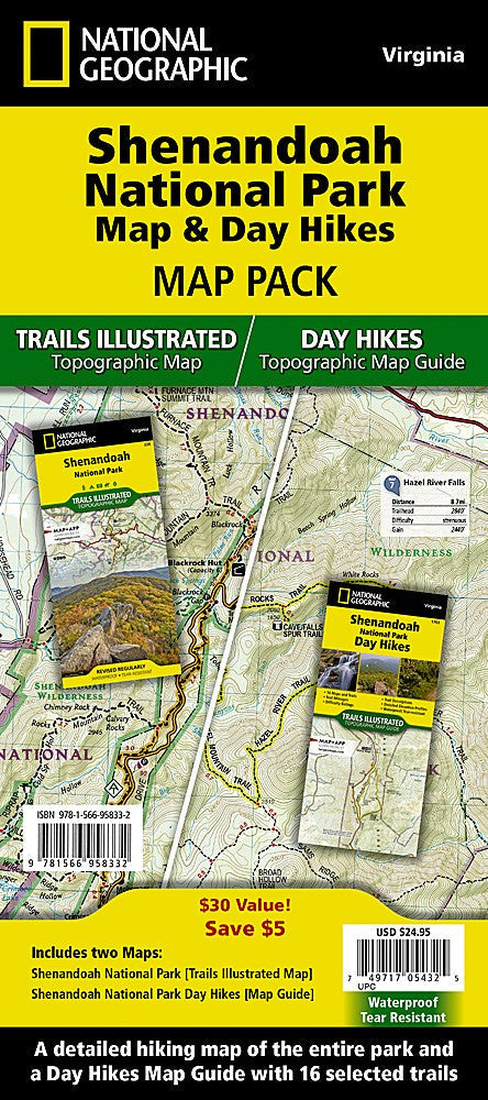
Shenandoah National Park Day Hikes: Map Pack Bundle
Shenandoah National Park Day Hikes: Map Pack Bundle
Couldn't load pickup availability
National Geographic Shenandoah National Park Day Hikes Map Pack Bundle — waterproof, tear-resistant Trails Illustrated maps covering the best day hikes throughout Shenandoah. For day hikers, families, and Appalachian Trail section hikers.
The National Geographic Shenandoah Day Hikes Map Pack Bundle includes the Trails Illustrated maps covering Shenandoah's best day hikes — waterfall walks, ridge-top vistas, and Appalachian Trail sections organized by region across the park. Detailed trail coverage, trailheads, and Skyline Drive access points on waterproof, tear-resistant paper.
Key specs
- SKU: NGTMG060
- Coverage: Shenandoah National Park day hikes (organized by region)
- Material: Waterproof, tear-resistant paper
- Features: Trail detail, trailheads, Skyline Drive access, AT sections, waterfall and vista routes
- Format: Multi-map bundle
Why it works
Shenandoah's 500+ miles of trails run the full length of the park along the Blue Ridge — a bundle covering the park by region ensures you have the detail needed for wherever you're entering along Skyline Drive without having to buy the full park map set. The waterfall and vista route detail goes beyond what a standard park map provides. Waterproof construction survives the humidity and rain common in the Blue Ridge year-round.
Ideal for
Day hikers, families, and Appalachian Trail section hikers exploring Shenandoah's waterfalls, vistas, and ridge trails. See also NGGM070 (Virginia Road Map) for broader regional access.
Share