National Geographic
Shenandoah National Park Day Hikes: Map & Guide
Shenandoah National Park Day Hikes: Map & Guide
Couldn't load pickup availability
National Geographic Trails Illustrated Shenandoah National Park Day Hikes Map & Guide #1703 — waterproof, tear-resistant. Coverage of the best day hikes in Shenandoah National Park including waterfalls, vistas, and Appalachian Trail sections along Skyline Drive. GPS-compatible.
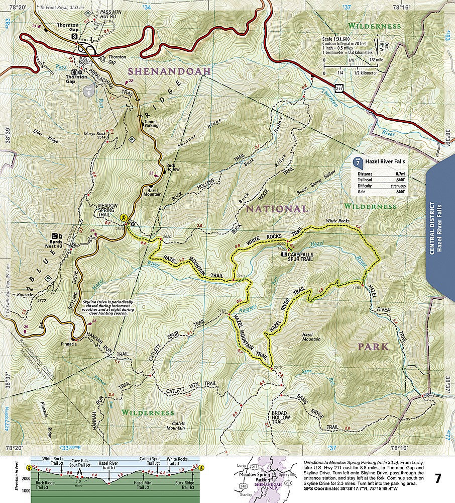
The National Geographic Trails Illustrated Shenandoah National Park Day Hikes Map & Guide covers the park's best day hikes organized by region along Skyline Drive — waterfall walks, ridge-top vistas, Appalachian Trail sections, and Old Rag Mountain. Trail descriptions, difficulty ratings, trailheads, and GPS coordinates are included.
Key specs
- SKU: NGTI1703
- Map number: 1703
- Coverage: Shenandoah National Park day hikes (organized by Skyline Drive region)
- Material: Waterproof, tear-resistant paper
- Features: Day hike routes, waterfall walks, vista hikes, AT sections, Old Rag, trail descriptions, GPS coordinates
Why it works
Shenandoah's 500+ miles of trails can be overwhelming for day visitors trying to choose the best hikes from a given Skyline Drive entrance — a day hike guide organized by region along the drive makes it easy to find the right hike for your location and ability level. The waterfall and vista route detail goes beyond what a standard park map provides. Waterproof construction survives the humidity and rain common in the Blue Ridge year-round.
Ideal for
Day hikers, families, and park visitors exploring Shenandoah National Park's waterfalls, vistas, and trails. See also NGTMG060 (Shenandoah Day Hikes Map Pack Bundle) for a multi-map set covering the full park.
Share