National Geographic
Sangre de Cristo & Great Sand Dunes: Map #138
Sangre de Cristo & Great Sand Dunes: Map #138
Couldn't load pickup availability
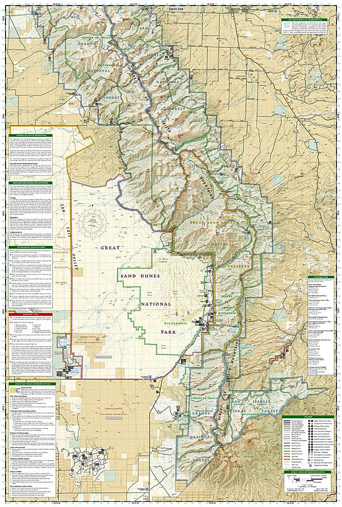
National Geographic Trails Illustrated Sangre de Cristo & Great Sand Dunes Map #138 — waterproof, tear-resistant, scale 1:63,360. Coverage of the Sangre de Cristo Mountains, Great Sand Dunes National Park, Blanca Peak, and surrounding wilderness areas. GPS-compatible.
The National Geographic Trails Illustrated Sangre de Cristo & Great Sand Dunes Map covers the southern Sangre de Cristo Range and Great Sand Dunes National Park in southern Colorado. Blanca Peak (Colorado's fourth-highest 14er), the Crestone Peaks, Medano Creek, and surrounding wilderness areas are mapped with trails, trailheads, and GPS coordinates.
Key specs
- SKU: NGTI138
- Map number: 138
- Scale: 1:63,360
- Coverage: Sangre de Cristo Mountains & Great Sand Dunes NP, Colorado
- Material: Waterproof, tear-resistant paper
- Features: Trails, 14er routes, Great Sand Dunes coverage, trailheads, GPS coordinates
Why it works
The Sangre de Cristo Range and Great Sand Dunes occupy a unique landscape where 14,000-foot peaks rise directly above North America's tallest sand dunes — a combination that requires a map covering both the alpine terrain and the dune field access routes. The Crestone Peaks are among Colorado's most technically demanding 14ers, requiring detailed topographic mapping for safe route-finding. Waterproof construction survives the afternoon thunderstorms common in the southern Sangres.
Ideal for
Mountaineers, backpackers, and national park visitors exploring the Sangre de Cristo Mountains, Great Sand Dunes, and Blanca Peak area. See also NGTI139 (La Garita, Cochetopa Hills) for adjacent coverage to the northwest.
Share