National Geographic
Salida St Elmo Mount Shavano CO Waterproof Topo Map Hiking Camping Trail #130
Salida St Elmo Mount Shavano CO Waterproof Topo Map Hiking Camping Trail #130
Couldn't load pickup availability
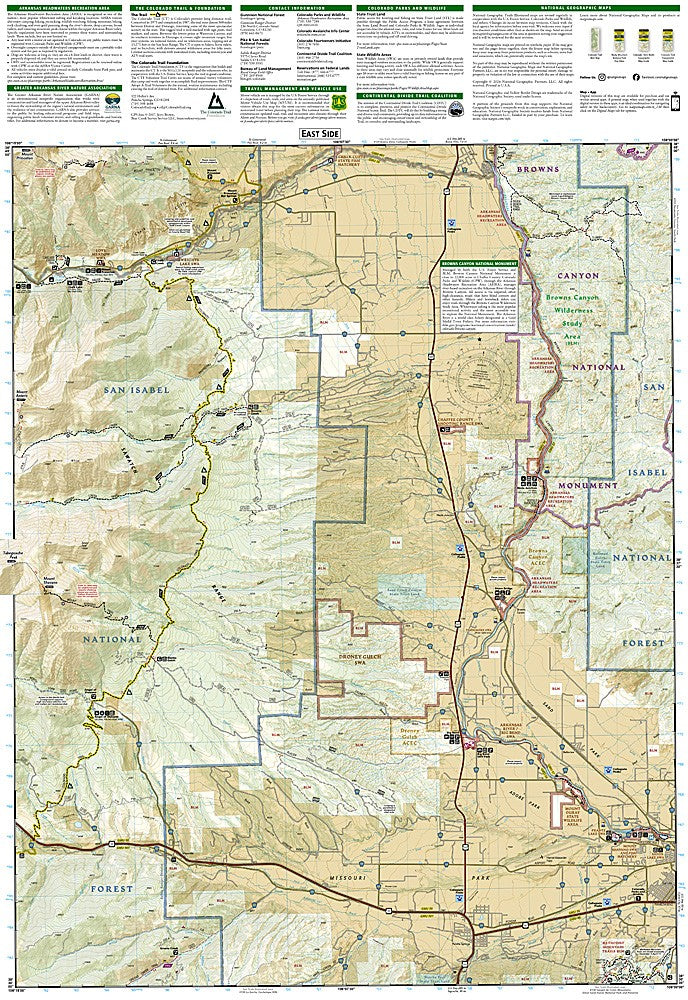
National Geographic Trails Illustrated Salida, St. Elmo & Mount Shavano Map #130 — waterproof, tear-resistant, scale 1:63,360. Coverage of the Salida area, St. Elmo ghost town, Mount Shavano, and surrounding San Isabel National Forest in central Colorado. GPS-compatible.
The National Geographic Trails Illustrated Salida, St. Elmo & Mount Shavano Map covers the Salida area of central Colorado — Mount Shavano and Mount Tabeguache (two Sawatch Range 14ers), the St. Elmo ghost town, Chalk Creek Canyon, and surrounding San Isabel National Forest. Trails, 14er routes, 4WD roads, trailheads, and GPS coordinates are mapped in detail.
Key specs
- SKU: NGTI130
- Map number: 130
- Scale: 1:63,360
- Coverage: Salida, St. Elmo & Mount Shavano area, Colorado (Sawatch Range)
- Material: Waterproof, tear-resistant paper
- Features: Trails, Mount Shavano & Tabeguache routes, St. Elmo ghost town, 4WD roads, trailheads, GPS coordinates
Why it works
The Salida area offers a combination of 14er climbing, ghost town exploration, and hot springs that attracts a wide range of outdoor visitors — a map covering all three activities in one sheet is more practical than managing multiple maps. St. Elmo is one of Colorado's best-preserved ghost towns, accessible via 4WD road from Chalk Creek Canyon, and the surrounding trail network requires accurate mapping for navigation. Waterproof construction survives the Sawatch Range's afternoon thunderstorms.
Ideal for
Peak baggers, 4WD enthusiasts, and outdoor explorers visiting Mount Shavano, St. Elmo, and the Salida area in central Colorado. See also NGTI129 (Buena Vista, Collegiate Peaks) for adjacent coverage to the north.
Share