National Geographic
Rand, Stillwater Pass: Map #115
Rand, Stillwater Pass: Map #115
Couldn't load pickup availability
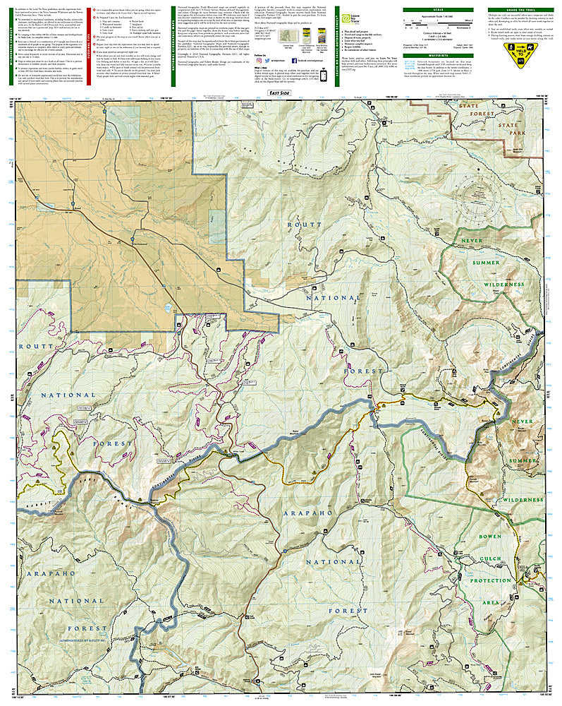
National Geographic Trails Illustrated Rand & Stillwater Pass Map #115 — waterproof, tear-resistant, scale 1:63,360. Coverage of the Rand area, Stillwater Pass, Never Summer Wilderness, and surrounding Routt National Forest in northern Colorado. GPS-compatible.
The National Geographic Trails Illustrated Rand & Stillwater Pass Map covers the remote terrain of northern Colorado's Routt National Forest — Stillwater Pass, the Never Summer Wilderness, the Illinois River drainage, and surrounding forest lands near Rand. Trails, OHV routes, hunting areas, wilderness boundaries, trailheads, and GPS coordinates are mapped in detail.
Key specs
- SKU: NGTI115
- Map number: 115
- Scale: 1:63,360
- Coverageprint books: Rand & Stillwater Pass area, Routt National Forest, Colorado
- Material: Waterproof, tear-resistant paper
- Features: Trails, Never Summer Wilderness, Stillwater Pass, OHV routes, hunting areas, GPS coordinates
Why it works
The Rand and Stillwater Pass area is one of northern Colorado's most remote and least-visited recreation zones, with the Never Summer Wilderness offering rugged backcountry hiking and the surrounding forest providing extensive hunting and OHV terrain — accurate mapping is essential for navigation in this area where cell service is nonexistent. Waterproof construction survives the variable weather common in northern Colorado's high-altitude terrain.
Ideal for
Hunters, OHV riders, backpackers, and wilderness lovers exploring the Rand and Stillwater Pass area of Routt National Forest in northern Colorado. See also NGTI116 (Hahns Peak & Steamboat Lake) for adjacent coverage to the northwest.
Share