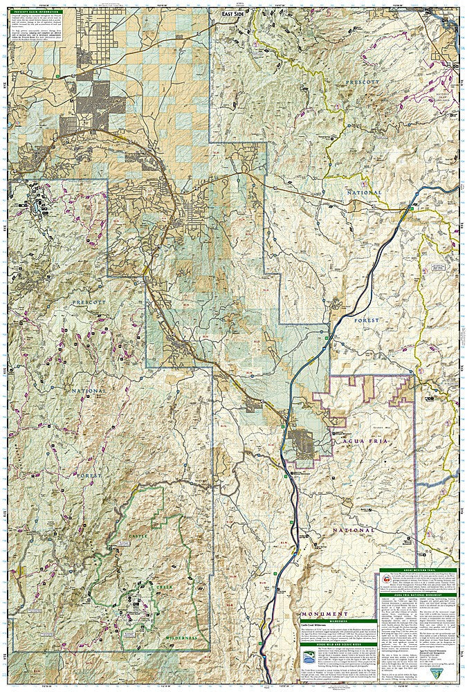
National Geographic Trails Illustrated Prescott National Forest Map Bundle — waterproof, tear-resistant, detailed topography, trails, scenic byways, and wilderness areas. For hikers, mountain bikers, and campers in central Arizona.
The National Geographic Prescott National Forest Map Bundle includes the Trails Illustrated maps covering the Prescott National Forest — the Bradshaw Mountains, Mingus Mountain, and surrounding forest lands in central Arizona. Detailed topography, trail networks, scenic byways, wilderness areas, and campgrounds on waterproof, tear-resistant paper.
Key specs
- SKU: NGTIB297
- Coverage: Prescott National Forest, Arizona
- Material: Waterproof, tear-resistant paper
- Features: Detailed topography, trails, scenic byways, wilderness areas, campgrounds
- Format: Multi-map bundle
Why it works
Prescott National Forest's multiple districts span a large area of central Arizona's transition zone between the Sonoran Desert and the Colorado Plateau, with a diverse trail network that requires more than one map for complete coverage. The forest is a popular year-round recreation destination for Phoenix and Prescott residents, with trails ranging from desert foothills to pine-forested mountain summits. Waterproof construction handles Arizona's monsoon rain and the temperature extremes common in the transition zone.
Ideal for
Hikers, mountain bikers, campers, and OHV riders exploring Prescott National Forest's trails, wilderness areas, and scenic byways in central Arizona. See also NGTIB298 (Coconino National Forest Bundle) for adjacent coverage.