National Geographic Maps
Prague City Destination Map
Prague City Destination Map
Couldn't load pickup availability
National Geographic City Destination Map of Prague — waterproof, tear-resistant, detailed street map with transit routes, cultural landmarks, and Greater Prague inset. Scale 1:6,700 city center. Folded 4" x 8.75".
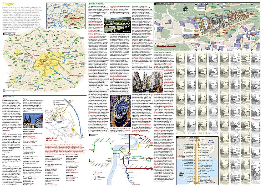
The National Geographic Prague City Destination Map covers central Prague with a complete street index, including Old Town, Lesser Town, New Town, Charles Bridge, Prague Castle, St. Vitus Cathedral, Old Town Square, and Wenceslas Square. Metro lines, tramways, and bus connections are mapped. Museums, theaters, restaurants, shopping, and nightlife are marked. Includes Greater Prague inset and airport connections.
Key specs
- SKU: NGDC015
- Coverage: Prague city center and Greater Prague
- Scale: 1:6,700 (city center); varies for insets
- Folded size: 4" x 8.75"
- Flat size: 26" x 38"
- Material: Waterproof, tear-resistant synthetic paper
Why it works
Prague's historic center is a dense, winding medieval street network where GPS navigation frequently fails or misleads — a detailed printed city map is essential for navigating on foot between the castle, Old Town, and Lesser Town. The transit overlay showing metro, tram, and bus lines makes it easy to combine walking with public transport. Waterproof construction survives the rain common in Central Europe without smearing or tearing.
Ideal for
Tourists, students, and travelers exploring Prague's castles, cathedrals, and historic squares. See also NGAM3322 (Czech Republic Adventure Map) for broader country coverage and NGAM009 (Czech Republic & Prague bundle) for both in one purchase.
Share