National Geographic
Pisgah National Forest: Map #780
Pisgah National Forest: Map #780
Couldn't load pickup availability
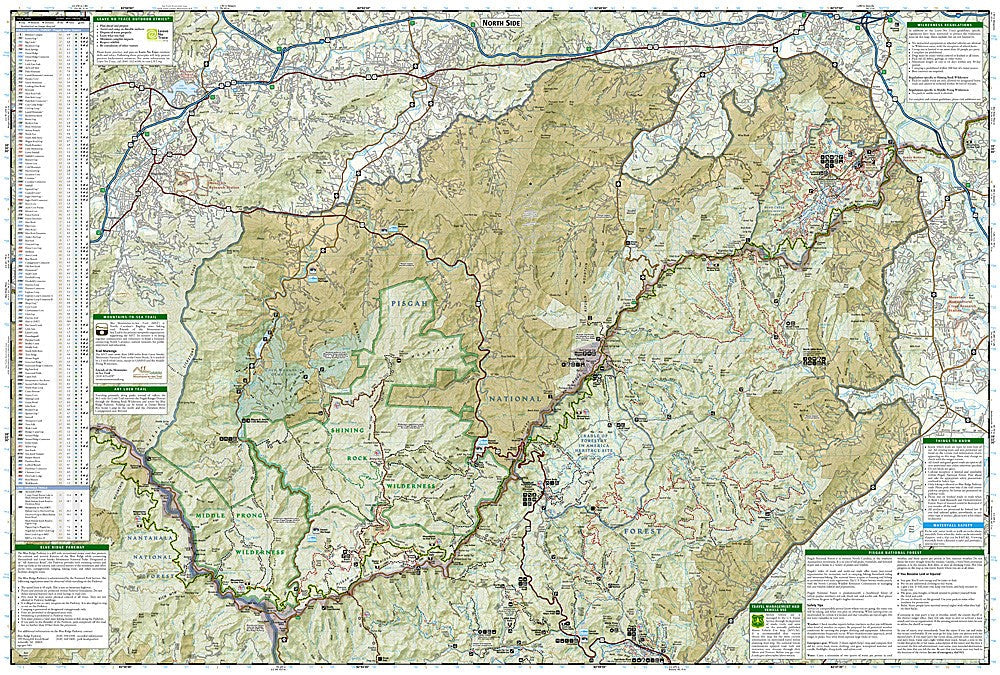
National Geographic Trails Illustrated Pisgah National Forest Map #780 — waterproof, tear-resistant. Coverage of the Pisgah Ranger District, Shining Rock Wilderness, Middle Prong Wilderness, and surrounding Pisgah National Forest in North Carolina. GPS-compatible.
The National Geographic Trails Illustrated Pisgah National Forest Map covers the Pisgah Ranger District in western North Carolina including the Shining Rock Wilderness, Middle Prong Wilderness, Black Balsam Knob, and the Looking Glass Rock area. Trails, waterfalls, wilderness boundaries, trailheads, and GPS coordinates are mapped in detail.
Key specs
- SKU: NGTI780
- Map number: 780
- Coverage: Pisgah National Forest (Pisgah Ranger District), North Carolina
- Material: Waterproof, tear-resistant paper
- Features: Trails, Shining Rock Wilderness, waterfalls, wilderness boundaries, trailheads, GPS coordinates
Why it works
The Pisgah Ranger District is one of the most popular outdoor recreation areas in the Southeast, with a dense trail network around Looking Glass Rock, the Shining Rock Wilderness, and numerous waterfalls that requires detailed mapping to navigate efficiently. The Shining Rock Wilderness has no maintained trails — accurate topographic mapping is essential for safe navigation in this off-trail terrain. Waterproof construction survives the frequent rain and high humidity common in the southern Appalachians.
Ideal for
Hikers, backpackers, mountain bikers, and waterfall seekers exploring the Pisgah National Forest's Pisgah Ranger District in western North Carolina. See also NGTIB294 (Pisgah National Forest Bundle) for complete forest coverage.
Share