National Geographic
Pikes Peak & Canon City: Map #137
Pikes Peak & Canon City: Map #137
Couldn't load pickup availability
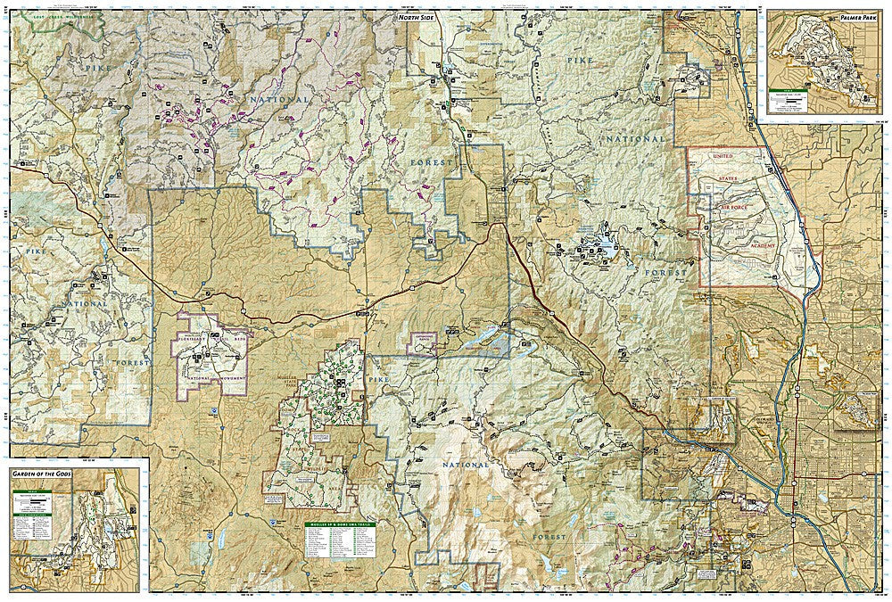
National Geographic Trails Illustrated Pikes Peak & Canon City Map #137 — waterproof, tear-resistant, scale 1:63,360. Coverage of Pikes Peak, Mueller State Park, Royal Gorge, and surrounding Pike National Forest. GPS-compatible.
The National Geographic Trails Illustrated Pikes Peak & Canon City Map covers the Pikes Peak massif, Mueller State Park, the Royal Gorge area, and surrounding Pike National Forest in central Colorado. Trails, 14er routes on Pikes Peak, the Barr Trail, trailheads, and GPS coordinates are mapped in detail.
Key specs
- SKU: NGTI137
- Map number: 137
- Scale: 1:63,360
- Coverage: Pikes Peak & Canon City area, Colorado
- Material: Waterproof, tear-resistant paper
- Features: Trails, Barr Trail, Pikes Peak routes, Mueller State Park, Royal Gorge, trailheads, GPS coordinates
Why it works
Pikes Peak is one of Colorado's most visited 14ers with multiple approach routes — the Barr Trail, the Cog Railway corridor, and the Pikes Peak Highway all require different navigation detail that a single accurate topo map provides. Mueller State Park's extensive trail network and the Royal Gorge area add significant recreation coverage beyond the summit routes. Waterproof construction survives the afternoon thunderstorms that are a constant hazard on Pikes Peak's exposed upper slopes.
Ideal for
Hikers, mountaineers, and outdoor enthusiasts exploring Pikes Peak, Mueller State Park, and the Royal Gorge area in central Colorado. See also NGTI135 (Deckers, Rampart Range) for adjacent coverage to the north.
Share