National Geographic
Pagosa Springs Bayfield CO Waterproof Topographic Map Hiking Camping #145
Pagosa Springs Bayfield CO Waterproof Topographic Map Hiking Camping #145
Couldn't load pickup availability
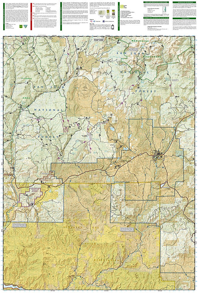
National Geographic Trails Illustrated Pagosa Springs & Bayfield Map #145 — waterproof, tear-resistant, scale 1:63,360. Coverage of the Pagosa Springs and Bayfield area including San Juan National Forest, Weminuche Wilderness access, and surrounding southwest Colorado terrain. GPS-compatible.
The National Geographic Trails Illustrated Pagosa Springs & Bayfield Map covers the Pagosa Springs and Bayfield area of southwest Colorado — San Juan National Forest, the eastern Weminuche Wilderness access points, the San Juan River, hot springs, and surrounding terrain. Trails, campgrounds, trailheads, river access, and GPS coordinates are mapped in detail.
Key specs
- SKU: NGTI145
- Map number: 145
- Scale: 1:63,360
- Coverage: Pagosa Springs & Bayfield area, Colorado (San Juan National Forest)
- Material: Waterproof, tear-resistant paper
- Features: Trails, Weminuche Wilderness access, San Juan River, hot springs, campgrounds, GPS coordinates
Why it works
Pagosa Springs serves as the eastern gateway to the Weminuche Wilderness, and the surrounding San Juan National Forest offers extensive hiking, fishing, and camping that requires detailed mapping to navigate. The area's hot springs and the San Juan River add recreation coverage beyond the trail network. Waterproof construction survives the San Juan Mountains' afternoon thunderstorms and the variable weather common in southwest Colorado.
Ideal for
Hikers, backpackers, anglers, and campers exploring the Pagosa Springs area, San Juan National Forest, and eastern Weminuche Wilderness access in southwest Colorado. See also NGTI140 (Weminuche Wilderness) for the wilderness interior.
Share