National Geographic
Pacific Crest Trail, San Jacinto & Laguna Mountains: Map #1012
Pacific Crest Trail, San Jacinto & Laguna Mountains: Map #1012
Couldn't load pickup availability
National Geographic Trails Illustrated Pacific Crest Trail San Jacinto & Laguna Mountains Map #1012 — waterproof, tear-resistant. Coverage of the PCT through the San Jacinto Mountains and Laguna Mountains in Southern California. GPS-compatible.
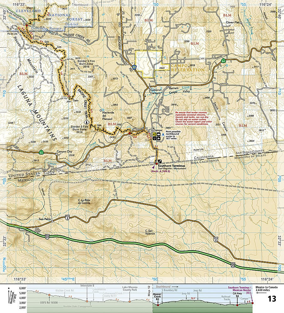
The National Geographic Trails Illustrated PCT San Jacinto & Laguna Mountains Map covers the Pacific Crest Trail through the San Jacinto Mountains — including the climb from the desert floor to the summit of Mount San Jacinto — and the Laguna Mountains section in San Diego County. Trail route, water sources, campsites, trailheads, and GPS coordinates are mapped in detail.
Key specs
- SKU: NGTI1012
- Map number: 1012
- Coverage: PCT through San Jacinto & Laguna Mountains, Southern California
- Material: Waterproof, tear-resistant paper
- Features: PCT route, water sources, campsites, trailheads, GPS coordinates
Why it works
The San Jacinto section of the PCT includes one of the most dramatic elevation gains on the entire trail — from the desert floor near Palm Springs to over 10,000 feet on the San Jacinto Plateau — requiring detailed topographic mapping for safe navigation. Water sources are scarce and critical in this desert section, making the water source detail on this map essential for PCT hikers. Waterproof construction survives the desert heat and the occasional rain that can turn desert washes into hazards.
Ideal for
PCT thru-hikers and section hikers navigating the San Jacinto and Laguna Mountains sections of the Pacific Crest Trail. See also NGTI1011 (PCT San Gabriel & San Bernardino) for the adjacent section to the north.
Share