National Geographic
Ozark National Scenic Riverways: Map #260
Ozark National Scenic Riverways: Map #260
Couldn't load pickup availability
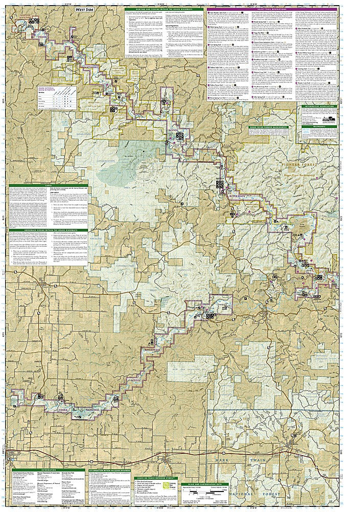
National Geographic Trails Illustrated Ozark National Scenic Riverways Map #260 — waterproof, tear-resistant. Coverage of the Ozark National Scenic Riverways including the Current River and Jacks Fork River corridors in Missouri. GPS-compatible.
The National Geographic Trails Illustrated Ozark National Scenic Riverways Map covers the Current River and Jacks Fork River corridors in southern Missouri — the first national scenic riverway in the US. River access points, campgrounds, springs, caves, hiking trails, and surrounding Ozark National Forest lands are mapped in detail with GPS coordinates.
Key specs
- SKU: NGTI260
- Map number: 260
- Coverage: Ozark National Scenic Riverways, Missouri (Current River & Jacks Fork)
- Material: Waterproof, tear-resistant paper
- Features: River access, campgrounds, springs, caves, hiking trails, GPS coordinates
Why it works
The Current River and Jacks Fork are among the clearest spring-fed rivers in the US, making them premier float trip destinations — a map with river access points, campground locations, and spring detail is essential for planning multi-day canoe and kayak trips. The Ozarks' numerous caves and springs add significant points of interest that require accurate location detail. Waterproof construction is essential for river use where maps are constantly exposed to water.
Ideal for
Canoeists, kayakers, campers, and nature lovers exploring the Ozark National Scenic Riverways' Current River and Jacks Fork in Missouri.
Share