National Geographic
Olympic National Park: Map #216
Olympic National Park: Map #216
Couldn't load pickup availability
National Geographic Trails Illustrated Olympic National Park Map #216 — waterproof, tear-resistant. Coverage of Olympic National Park including the Olympic Peninsula's rainforest, alpine terrain, and Pacific coastline. GPS-compatible.
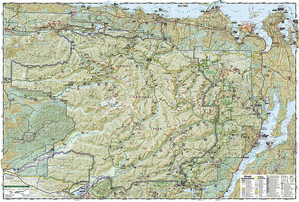
The National Geographic Trails Illustrated Olympic National Park Map covers the full Olympic National Park — the Hoh Rain Forest, Hurricane Ridge, the Elwha River corridor, the Quinault Rain Forest, and the Pacific coast wilderness strip. Trails, backcountry campsites, coastal access, visitor facilities, and GPS coordinates are mapped in detail.
Key specs
- SKU: NGTI216
- Map number: 216
- Coverage: Olympic National Park, Washington
- Material: Waterproof, tear-resistant paper
- Features: Trails, Hoh Rain Forest, Hurricane Ridge, coastal strip, backcountry campsites, GPS coordinates
Why it works
Olympic National Park encompasses three completely different ecosystems — temperate rainforest, alpine terrain, and Pacific coastline — spread across a large peninsula that requires a map covering all three zones to plan a complete park visit. The coastal wilderness strip requires tide table awareness and accurate beach access detail for safe navigation. Waterproof construction is essential in Olympic, which receives some of the highest rainfall in the continental US and where maps are exposed to constant moisture in the rainforest and coastal environments.
Ideal for
Hikers, backpackers, and park visitors exploring Olympic National Park's rainforests, alpine terrain, and Pacific coastline. See also NGTIB202 (Washington National Parks Bundle) for all three Washington national parks.
Share