National Geographic
Northville-Placid Trail: Map #736
Northville-Placid Trail: Map #736
Couldn't load pickup availability
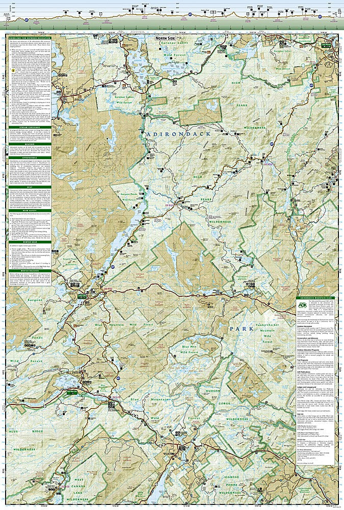
National Geographic Trails Illustrated Northville-Placid Trail Map #736 — waterproof, tear-resistant. Complete coverage of the 133-mile Northville-Placid Trail through the Adirondack Park in New York. GPS-compatible.
The National Geographic Trails Illustrated Northville-Placid Trail Map covers the complete 133-mile NPT route through the Adirondack Park from Northville to Lake Placid. Trail route, lean-tos, water sources, road crossings, and the surrounding Adirondack wilderness are mapped in detail with GPS coordinates.
Key specs
- SKU: NGTI736
- Map number: 736
- Coverage: Northville-Placid Trail, Adirondack Park, New York (133 miles)
- Material: Waterproof, tear-resistant paper
- Features: Complete NPT route, lean-tos, water sources, road crossings, GPS coordinates
Why it works
The Northville-Placid Trail is the Adirondacks' premier long-distance hiking route, passing through some of the most remote wilderness in the northeastern US — a dedicated map covering the complete route with lean-to and water source detail is essential for planning multi-day trips where resupply options are limited. The trail's remote character means accurate navigation is critical, particularly in the sections far from roads. Waterproof construction survives the Adirondacks' frequent rain and the stream crossings common throughout the route.
Ideal for
Thru-hikers and backpackers completing the Northville-Placid Trail through the Adirondack Park. See also NGTIB022 (Adirondack Park Map Pack Bundle) for complete Adirondack coverage.
Share