National Geographic
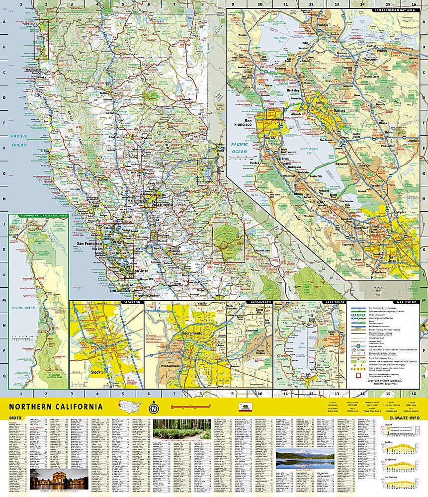
Northern California Road Map & Travel Guide
Northern California Road Map & Travel Guide
Couldn't load pickup availability
Waterproof, tear-resistant road map and travel guide for Northern California — highways, scenic routes, points of interest, and inset city maps. Scale 1:1,900,000.
The National Geographic Northern California Guide Map combines a detailed road map with a curated travel guide for the northern half of the Golden State. Major highways, scenic byways, and secondary roads are clearly marked alongside hundreds of points of interest — national and state parks, campgrounds, visitor centers, airports, and ski areas. Inset maps cover San Francisco Bay Area, Yosemite National Park, Lake Tahoe, Sacramento, Stockton, and Redwood National and State Parks.
Key specs
- SKU: NGGM007
- Scale: 1:1,900,000
- Folded size: 4" x 8.75"
- Flat size: 20.75" x 17.75"
- Material: Waterproof, tear-resistant synthetic paper
- Weight: ~1.3 oz
- Model: GM00620545
What's included:
- Full Northern California road network with mileage markers
- Inset maps: San Francisco Bay Area, Yosemite, Lake Tahoe, Sacramento, Stockton, Redwood Parks
- Points of interest: national/state parks, campgrounds, airports, ski areas, visitor centers, hospitals
- Scenic routes, climate info, and park service chart
- City and town index
Why it works
Northern California spans an enormous range of terrain — from the Redwood Coast and Shasta Cascades to the Sierra Nevada and Bay Area — making a single accurate road map with inset city detail essential for planning multi-destination trips. Waterproof synthetic paper survives the coastal fog, rain, and river crossings common throughout the region without tearing or smearing.
Ideal for
Road trippers, outdoor adventurers, and travelers exploring Northern California's national parks, coastline, and scenic byways.
Share