National Geographic
North Cascades National Park: Map #223
North Cascades National Park: Map #223
Couldn't load pickup availability
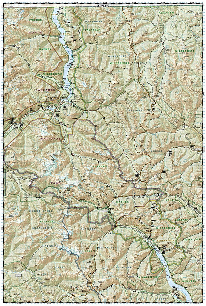
National Geographic Trails Illustrated North Cascades National Park Map #223 — waterproof, tear-resistant. Coverage of North Cascades National Park including the Ross Lake National Recreation Area, Lake Chelan National Recreation Area, and surrounding wilderness. GPS-compatible.
The National Geographic Trails Illustrated North Cascades National Park Map covers the full North Cascades National Park complex — the North and South Units, Ross Lake National Recreation Area, and Lake Chelan National Recreation Area. Trails, backcountry campsites, glacier coverage, lake access, and GPS coordinates are mapped in detail.
Key specs
- SKU: NGTI223
- Map number: 223
- Coverage: North Cascades National Park complex, Washington
- Material: Waterproof, tear-resistant paper
- Features: Trails, backcountry campsites, glaciers, Ross Lake, Lake Chelan, GPS coordinates
Why it works
North Cascades National Park is one of the most rugged and least visited national parks in the lower 48 states, with a complex backcountry of glaciers, remote valleys, and challenging terrain that requires detailed topographic mapping for safe navigation. The park's three separate units — connected by the North Cascades Highway — require a map covering all three to plan a complete park visit. Waterproof construction is essential in the North Cascades, where rain is among the heaviest in the continental US. See also NGTIB202 (Washington National Parks Bundle) for coverage of all three Washington national parks.
Ideal for
Backpackers, climbers, and wilderness lovers exploring North Cascades National Park's remote valleys, glaciers, and backcountry. See also NGTI827 (Glacier Peak Wilderness) for adjacent wilderness coverage to the south.
Share