National Geographic
New River Gorge National Park WV Waterproof Topo Map Hiking Camping Trail #242
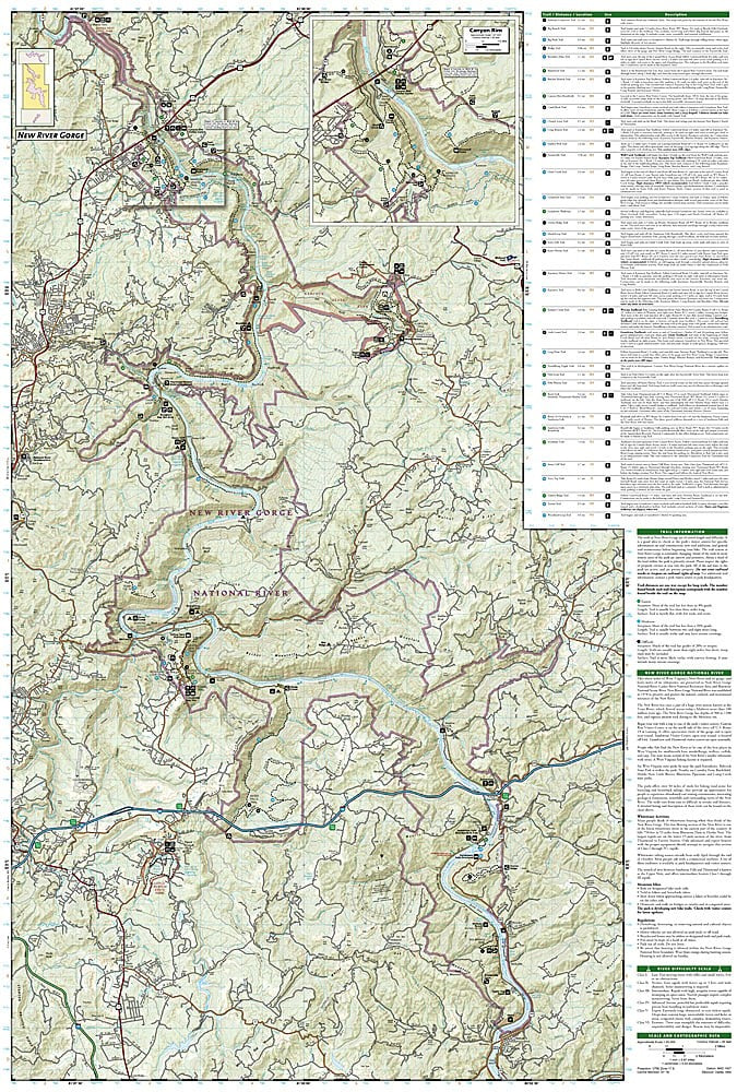
New River Gorge National Park WV Waterproof Topo Map Hiking Camping Trail #242
Couldn't load pickup availability
National Geographic Trails Illustrated New River Gorge National Park Map #242 — waterproof, tear-resistant. Coverage of New River Gorge National Park including hiking trails, climbing areas, whitewater sections, and the surrounding gorge in West Virginia. GPS-compatible.
The National Geographic Trails Illustrated New River Gorge National Park Map covers the full national park — the gorge rim trails, Long Point Trail, Grandview, the Endless Wall climbing area, whitewater sections of the New River, and surrounding park lands. Trails, climbing areas, river access, campgrounds, and GPS coordinates are mapped in detail.
Key specs
- SKU: NGTI242
- Map number: 242
- Coverage: New River Gorge National Park, West Virginia
- Material: Waterproof, tear-resistant paper
- Features: Hiking trails, climbing areas, whitewater sections, river access, campgrounds, GPS coordinates
Why it works
New River Gorge is one of the premier rock climbing destinations in the eastern US, with hundreds of routes on the Endless Wall and surrounding sandstone cliffs that require accurate approach trail mapping. The park's whitewater sections attract paddlers who need river access and rapid detail. The gorge's complex terrain — with trails descending steeply from the rim to the river — requires detailed topographic mapping for safe navigation. Waterproof construction survives West Virginia's frequent rain and the humidity common in the gorge.
Ideal for
Climbers, hikers, paddlers, and park visitors exploring New River Gorge National Park's trails, climbing areas, and whitewater in West Virginia. See also NGTI773 (New River Blueway) for the full river corridor coverage.
Share