National Geographic
New River Blueway: Map #773
New River Blueway: Map #773
Couldn't load pickup availability
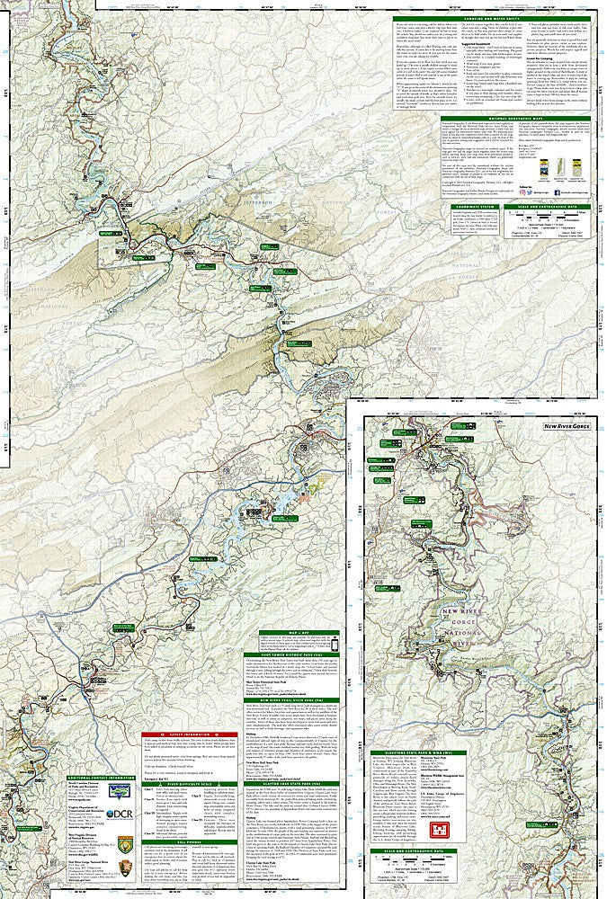
National Geographic Trails Illustrated New River Blueway Map #773 — waterproof, tear-resistant. Coverage of the New River Blueway paddling corridor through Virginia and West Virginia, including New River Gorge National Park. GPS-compatible.
The National Geographic Trails Illustrated New River Blueway Map covers the New River paddling corridor from the Virginia highlands through New River Gorge National Park in West Virginia. River access points, rapids classifications, campgrounds, hiking trails, and the surrounding national park and forest lands are mapped in detail with GPS coordinates.
Key specs
- SKU: NGTI773
- Map number: 773
- Coverage: New River Blueway, Virginia and West Virginia
- Material: Waterproof, tear-resistant paper
- Features: River access, rapids classifications, campgrounds, hiking trails, GPS coordinates
Why it works
The New River is one of the oldest rivers in North America and one of the premier whitewater and flatwater paddling destinations in the eastern US — a dedicated river map with access points, rapids classifications, and campground detail is essential for planning multi-day float trips. The New River Gorge National Park designation adds hiking trail coverage that makes this map useful for both paddlers and hikers. Waterproof construction is essential for river use where maps are constantly exposed to water.
Ideal for
Paddlers, hikers, and outdoor enthusiasts exploring the New River Blueway and New River Gorge National Park in Virginia and West Virginia. See also NGTI242 (New River Gorge National Park) for focused national park coverage.
Share