National Geographic
Saranac, Paul Smiths: Map #746
Saranac, Paul Smiths: Map #746
Couldn't load pickup availability
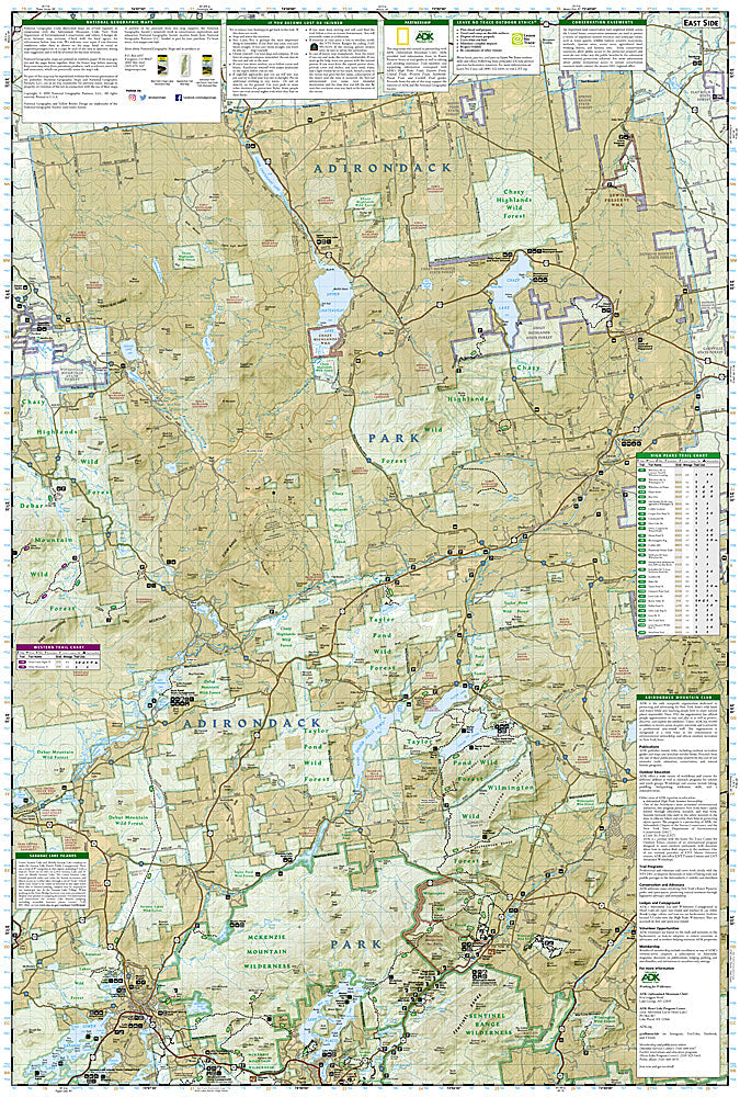
National Geographic Trails Illustrated Saranac & Paul Smiths Map #746 — waterproof, tear-resistant. Coverage of the Saranac Lake region, Paul Smiths, St. Regis Canoe Area, and surrounding Adirondack Park wilderness in New York. GPS-compatible.
The National Geographic Trails Illustrated Saranac & Paul Smiths Map covers the Saranac Lake region and Paul Smiths area of the Adirondack Park — the St. Regis Canoe Area (the only designated canoe area in New York State), the Saranac Lake chain, and surrounding Adirondack wilderness. Paddling routes, canoe carries, lean-tos, hiking trails, and GPS coordinates are mapped in detail.
Key specs
- SKU: NGTI746
- Map number: 746
- Coverage: Saranac & Paul Smiths area, Adirondack Park, New York
- Material: Waterproof, tear-resistant paper
- Features: Paddling routes, St. Regis Canoe Area, canoe carries, lean-tos, hiking trails, GPS coordinates
Why it works
The St. Regis Canoe Area is the only designated canoe area in New York State, with motorboat restrictions protecting a network of ponds and carries that require accurate portage and campsite mapping for multi-day canoe trips. The Saranac Lake chain's interconnected lakes and the surrounding Adirondack wilderness offer classic north woods paddling that benefits from detailed waterway mapping. Waterproof construction is essential in a lake and river environment where maps are constantly exposed to water.
Ideal for
Canoeists, kayakers, hikers, and Adirondack wilderness lovers exploring the St. Regis Canoe Area, Saranac Lakes, and Paul Smiths area. See also NGTI745 (Saranac & Upper St. Regis) for adjacent coverage.
Share