National Geographic
Wisconsin's Door Peninsula Destination Touring Map
Wisconsin's Door Peninsula Destination Touring Map
Couldn't load pickup availability
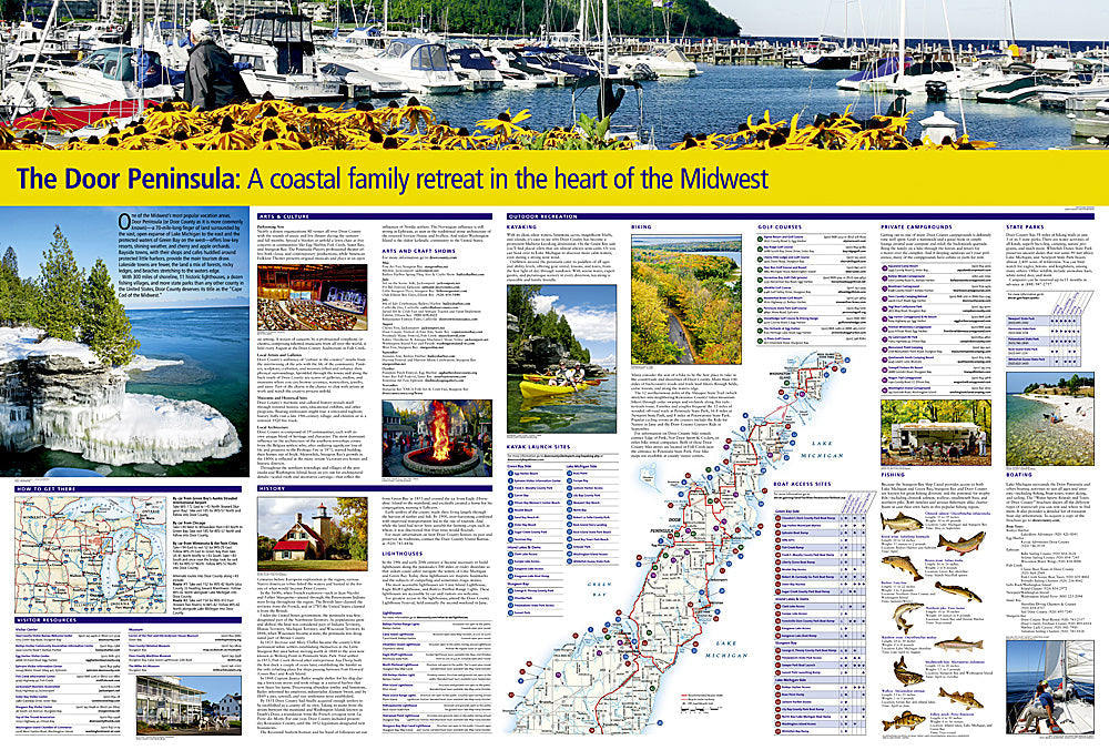
National Geographic Wisconsin's Door Peninsula Destination Touring Map — waterproof, tear-resistant, detailed maps of the peninsula and islands, parks, beaches, boat launches, lighthouses, and cultural points of interest. Folded 4" x 8.75".
The National Geographic Wisconsin's Door Peninsula Destination Touring Map covers Door County's scenic shoreline, state parks, beaches, boat launches, lighthouses, cherry orchards, and island ferry connections. Designed for coastal drives, boating, and exploring this distinctive Great Lakes peninsula.
Key specs
- SKU: NGDM009
- Coverage: Wisconsin's Door Peninsula and surrounding islands
- Folded size: 4" x 8.75"
- Material: Waterproof, tear-resistant synthetic paper
Why it works
Door County's peninsula and island geography — with multiple state parks, ferry connections to Washington Island, and a dense concentration of beaches, lighthouses, and attractions along both shorelines — requires a detailed regional map to navigate efficiently. Standard road maps don't include the boat launch, beach access, and island ferry detail that visitors need. Waterproof construction handles the lake weather and boat spray common throughout the region.
Ideal for
Road trippers, campers, boaters, and Great Lakes explorers visiting Wisconsin's Door Peninsula and Door County.
Share