National Geographic
Paunsaugunt Plateau, Mount Dutton: Map #705
Paunsaugunt Plateau, Mount Dutton: Map #705
Couldn't load pickup availability
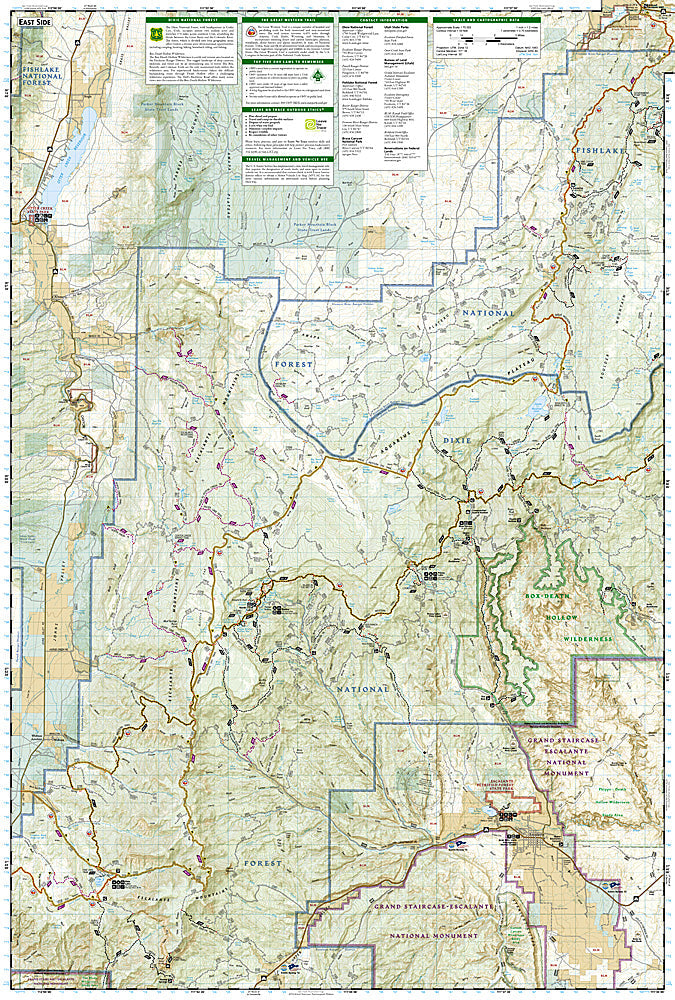
National Geographic Trails Illustrated Paunsaugunt Plateau & Mount Dutton Map #705 — waterproof, tear-resistant. Coverage of the Paunsaugunt Plateau, Mount Dutton, and surrounding Grand Staircase-Escalante National Monument terrain near Bryce Canyon in southern Utah. GPS-compatible.
The National Geographic Trails Illustrated Paunsaugunt Plateau & Mount Dutton Map covers the high plateau country south of Bryce Canyon — the Paunsaugunt Plateau, Mount Dutton, the Great Western Trail, and surrounding Grand Staircase-Escalante National Monument terrain. OHV and hiking trails, Great Western Trail route, campgrounds, and GPS coordinates are mapped in detail.
Key specs
- SKU: NGTI705
- Map number: 705
- Coverage: Paunsaugunt Plateau & Mount Dutton area, southern Utah
- Material: Waterproof, tear-resistant paper
- Features: Trails, Great Western Trail, OHV routes, Paunsaugunt Plateau, campgrounds, GPS coordinates
Why it works
The Paunsaugunt Plateau's high pine forests and red rock rim country offer a dramatically different experience from the crowded Bryce Canyon National Park just to the north — a detailed map of the plateau's OHV and hiking trail network is essential for visitors exploring beyond the national park boundary. The Great Western Trail's passage through the area adds significant long-distance route coverage. Waterproof construction survives the variable weather common on southern Utah's high plateaus.
Ideal for
OHV riders, hunters, hikers, and explorers visiting the Paunsaugunt Plateau and Mount Dutton area near Bryce Canyon in southern Utah. See also NGTI710 (Canyons of the Escalante) for adjacent canyon country coverage.
Share