National Geographic
SW Yellowstone, Old Faithful: Map #302
SW Yellowstone, Old Faithful: Map #302
Couldn't load pickup availability
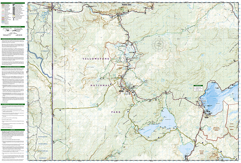
National Geographic Trails Illustrated SW Yellowstone & Old Faithful Map #302 — waterproof, tear-resistant. Coverage of the southwestern Yellowstone National Park quadrant including Old Faithful, the Upper and Lower Geyser Basins, Shoshone Lake, and the Continental Divide. GPS-compatible.
The National Geographic Trails Illustrated SW Yellowstone & Old Faithful Map covers the southwestern quadrant of Yellowstone National Park — Old Faithful, the Upper Geyser Basin, Lower Geyser Basin, Midway Geyser Basin (Grand Prismatic Spring), Shoshone Lake, and the Continental Divide Trail corridor. Trails, geyser basin features, backcountry campsites, and GPS coordinates are mapped in detail.
Key specs
- SKU: NGTI302
- Map number: 302
- Coverage: SW Yellowstone National Park (Old Faithful area), Wyoming
- Material: Waterproof, tear-resistant paper
- Features: Old Faithful, geyser basins, Grand Prismatic Spring, Shoshone Lake, CDT, backcountry campsites, GPS coordinates
Why it works
The Old Faithful area contains the world's highest concentration of geysers and hot springs, with the geyser basin boardwalk networks and the surrounding backcountry requiring detailed feature location mapping for both visitor safety and navigation. Shoshone Lake is the largest backcountry lake in the lower 48 states accessible only by trail or canoe, making accurate campsite and route mapping essential. Waterproof construction survives Yellowstone's variable weather and the thermal environment near geyser basins.
Ideal for
Hikers, backpackers, and park visitors exploring Old Faithful, the geyser basins, and the southwestern Yellowstone backcountry. See also NGTI201 (Yellowstone National Park) for full park coverage.
Share