National Geographic
Southeast Yellowstone Lake: Map #305
Southeast Yellowstone Lake: Map #305
Couldn't load pickup availability
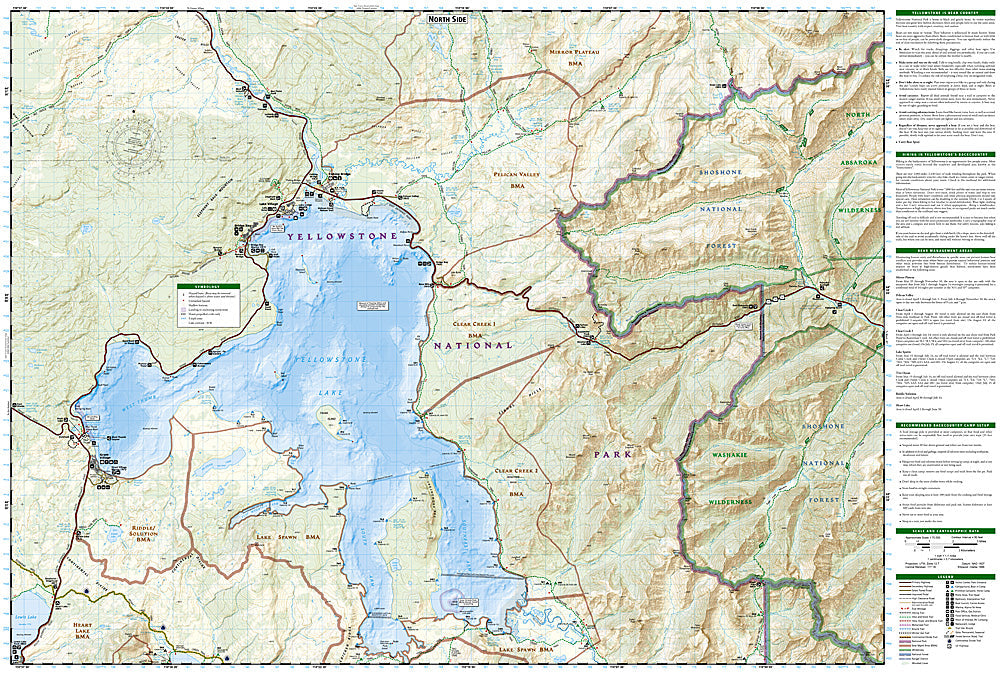
National Geographic Trails Illustrated Southeast Yellowstone & Yellowstone Lake Map #305 — waterproof, tear-resistant. Coverage of the southeastern quadrant of Yellowstone National Park including Yellowstone Lake, the Thorofare region, and the most remote backcountry in the lower 48. GPS-compatible.
The National Geographic Trails Illustrated Southeast Yellowstone & Yellowstone Lake Map covers the southeastern quadrant of Yellowstone — Yellowstone Lake's southern arms, the Thorofare region (the most remote point in the lower 48 states), the Two Ocean Plateau, and surrounding backcountry. Trails, backcountry campsites, lake kayaking routes, and GPS coordinates are mapped in detail.
Key specs
- SKU: NGTI305
- Map number: 305
- Coverage: Southeast Yellowstone & Yellowstone Lake, Wyoming
- Material: Waterproof, tear-resistant paper
- Features: Thorofare Trail, Yellowstone Lake arms, backcountry campsites, kayaking routes, GPS coordinates
Why it works
The Thorofare region is the most remote point in the contiguous US — over 30 miles from the nearest road in any direction — making accurate topographic mapping absolutely essential for the multi-day backcountry trips required to reach it. Yellowstone Lake's southern arms offer kayaking and backcountry camping that requires detailed campsite and water route mapping. Waterproof construction survives Yellowstone's unpredictable weather and the lake environment.
Ideal for
Experienced backpackers, kayakers, and wilderness lovers exploring the Thorofare region and Yellowstone Lake's backcountry. See also NGTI304 (Yellowstone Tower Canyon) and NGTI302 (SW Yellowstone) for adjacent quadrant coverage.
Share