National Geographic
Issaquah Alps: Map #824
Issaquah Alps: Map #824
Couldn't load pickup availability
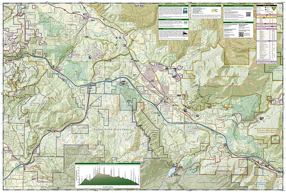
National Geographic Trails Illustrated Issaquah Alps Map #824 — waterproof, tear-resistant. Coverage of Tiger Mountain, Squak Mountain, and Cougar Mountain Regional Wildland Parks — the Issaquah Alps trail network east of Seattle, Washington. GPS-compatible.
The National Geographic Trails Illustrated Issaquah Alps Map covers the three mountains of the Issaquah Alps east of Seattle — Tiger Mountain State Forest, Squak Mountain State Park, and Cougar Mountain Regional Wildland Park. Hiking and equestrian trails, trailheads, and GPS coordinates are mapped in detail.
Key specs
- SKU: NGTI824
- Map number: 824
- Coverage: Issaquah Alps (Tiger, Squak & Cougar Mountains), Washington
- Material: Waterproof, tear-resistant paper
- Features: Trails, Tiger Mountain, Squak Mountain, Cougar Mountain, trailheads, GPS coordinates
Why it works
The Issaquah Alps' dense trail network across three separate mountains can be confusing to navigate without a map covering all three areas — a single map showing the full trail system and the connections between the mountains is essential for visitors planning routes across the range. Tiger Mountain's extensive trail network and Cougar Mountain's historical coal mining sites add significant coverage. Waterproof construction survives the Pacific Northwest's frequent rain year-round.
Ideal for
Trail runners, day hikers, equestrians, and Seattle-area outdoor enthusiasts exploring the Issaquah Alps' trail network. See also NGTI823 (Goat Rocks & Norse Peak Wilderness) for more remote Cascades coverage.
Share