National Geographic
Glacier Peak Wilderness: Map #827
Glacier Peak Wilderness: Map #827
Couldn't load pickup availability
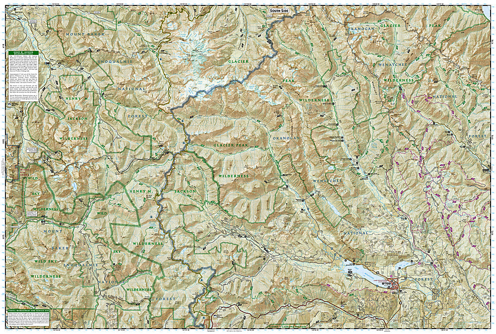
National Geographic Trails Illustrated Glacier Peak Wilderness Map #827 — waterproof, tear-resistant. Coverage of the Glacier Peak Wilderness including Glacier Peak's climbing routes, the Pacific Crest Trail, and surrounding North Cascades terrain in Washington. GPS-compatible.
The National Geographic Trails Illustrated Glacier Peak Wilderness Map covers the Glacier Peak Wilderness in the North Cascades — Glacier Peak (10,541 ft), the PCT corridor through the wilderness, the Suiattle River and White Chuck River drainages, and surrounding ancient forest and alpine terrain. Trails, PCT route, climbing routes, backcountry campsites, and GPS coordinates are mapped in detail.
Key specs
- SKU: NGTI827
- Map number: 827
- Coverage: Glacier Peak Wilderness, Washington (North Cascades)
- Material: Waterproof, tear-resistant paper
- Features: Trails, PCT corridor, Glacier Peak climbing routes, backcountry campsites, GPS coordinates
Why it works
Glacier Peak is one of the most remote and least-visited Cascade volcanoes — reaching its summit requires a multi-day approach through old-growth forest and alpine terrain that demands accurate topographic mapping. The PCT passes through the wilderness on one of its most scenic sections, making trail junction and campsite detail essential for thru-hikers. Waterproof construction is critical in the North Cascades, where rain is among the heaviest in the continental US and glacier travel exposes maps to constant moisture.
Ideal for
Mountaineers, PCT hikers, backpackers, and wilderness lovers exploring the Glacier Peak Wilderness in the North Cascades. See also NGTI223 (North Cascades National Park) for adjacent coverage to the north.
Share