National Geographic
Green Mountain National Forest South: Map #748
Green Mountain National Forest South: Map #748
Couldn't load pickup availability
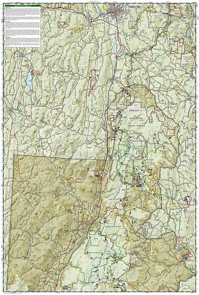
National Geographic Trails Illustrated Green Mountain National Forest South Map #748 — waterproof, tear-resistant. Coverage of the southern Green Mountain National Forest including the Appalachian Trail/Long Trail corridor, Glastenbury Wilderness, and surrounding Vermont highlands. GPS-compatible.
The National Geographic Trails Illustrated Green Mountain National Forest South Map covers the southern section of Green Mountain National Forest in Vermont — the Appalachian Trail and Long Trail corridor, Glastenbury Wilderness, Stratton Mountain, and surrounding forest terrain. Trails, AT/Long Trail route, wilderness boundaries, shelters, campgrounds, and GPS coordinates are mapped in detail.
Key specs
- SKU: NGTI748
- Map number: 748
- Coverage: Green Mountain National Forest South, Vermont
- Material: Waterproof, tear-resistant paper
- Features: Trails, AT/Long Trail, Glastenbury Wilderness, Stratton Mountain, shelters, campgrounds, GPS coordinates
Why it works
The southern Green Mountains are where the Long Trail and Appalachian Trail share their route through Vermont, with Stratton Mountain being the peak that inspired both Benton MacKaye (AT) and James Taylor (Long Trail) to create their respective trails — accurate trail junction and shelter detail is essential for hikers navigating both routes. The Glastenbury Wilderness's remote terrain requires detailed topographic mapping for safe navigation. Waterproof construction survives Vermont's frequent rain and the variable weather common in the Green Mountains year-round.
Ideal for
AT thru-hikers, Long Trail hikers, backpackers, and outdoor enthusiasts exploring the southern Green Mountain National Forest in Vermont. See also NGTI749 (Green Mountain National Forest North) for the northern section.
Share