National Geographic
Clinch Ranger District: Map #793
Clinch Ranger District: Map #793
Couldn't load pickup availability
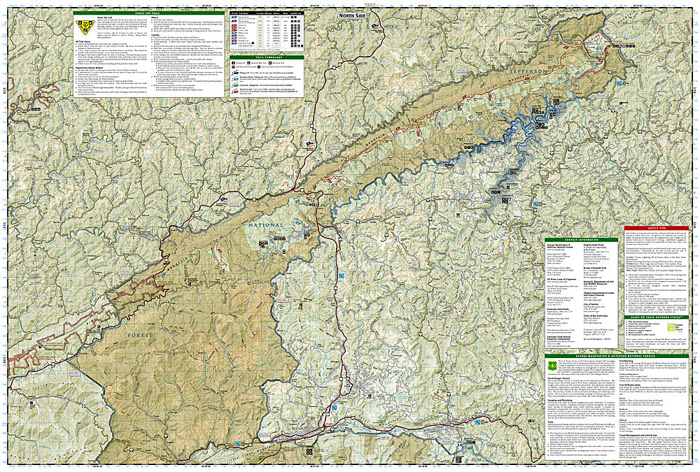
National Geographic Trails Illustrated Clinch Ranger District Map #793 — waterproof, tear-resistant. Coverage of the Clinch Ranger District of Jefferson National Forest including High Knob, the Chief Benge Scout Trail, and surrounding mountain lakes and trails in Virginia. GPS-compatible.
The National Geographic Trails Illustrated Clinch Ranger District Map covers the Clinch Ranger District of Jefferson National Forest in southwestern Virginia — High Knob Recreation Area, the Chief Benge Scout Trail, mountain lakes, and surrounding forest trails. Trails, fishing access, campgrounds, trailheads, and GPS coordinates are mapped in detail.
Key specs
- SKU: NGTI793
- Map number: 793
- Coverage: Clinch Ranger District, Jefferson National Forest, Virginia
- Material: Waterproof, tear-resistant paper
- Features: Trails, High Knob, Chief Benge Scout Trail, mountain lakes, campgrounds, GPS coordinates
Why it works
The Clinch Ranger District is one of the least-visited sections of Jefferson National Forest, offering remote hiking and fishing in southwestern Virginia's coal country mountains — a detailed map is essential for visitors navigating the forest road network and finding trailheads in this rural area. High Knob's fire tower and the Chief Benge Scout Trail's historical significance add points of interest that require accurate location detail. Waterproof construction survives the rain and humidity common in the Virginia highlands.
Ideal for
Hikers, anglers, campers, and outdoor enthusiasts exploring the Clinch Ranger District of Jefferson National Forest in southwestern Virginia. See also NGTI788 (Covington & Alleghany Highlands) for adjacent national forest coverage.
Share