National Geographic
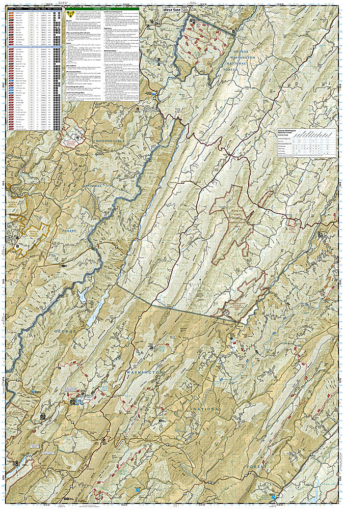
Staunton, Shenandoah Valley: Map #791
Staunton, Shenandoah Valley: Map #791
Couldn't load pickup availability
National Geographic Trails Illustrated Staunton & Shenandoah Valley Map #791 — waterproof, tear-resistant. Coverage of the George Washington National Forest near Staunton including Ramsey's Draft Wilderness, Shenandoah Mountain, and surrounding Virginia highlands. GPS-compatible.
The National Geographic Trails Illustrated Staunton & Shenandoah Valley Map covers the George Washington National Forest near Staunton, Virginia — the Ramsey's Draft Wilderness, Shenandoah Mountain, the Wild Oak Trail, and surrounding forest lands. Hiking and mountain biking trails, scenic overlooks, campgrounds, trailheads, and GPS coordinates are mapped in detail.
Key specs
- SKU: NGTI791
- Map number: 791
- Coverage: Staunton & Shenandoah Valley area, George Washington National Forest, Virginia
- Material: Waterproof, tear-resistant paper
- Features: Trails, Ramsey's Draft Wilderness, Wild Oak Trail, scenic overlooks, campgrounds, GPS coordinates
Why it works
The Ramsey's Draft Wilderness contains one of the finest stands of old-growth forest in the eastern US, and the Wild Oak Trail's 26-mile loop is one of Virginia's premier backpacking routes — detailed trail and campsite mapping is essential for planning overnight trips in this complex terrain. The George Washington National Forest's ridge-and-valley topography requires accurate mapping for navigation on the forest's extensive trail network. Waterproof construction survives the rain and humidity common in the Virginia highlands year-round.
Ideal for
Hikers, mountain bikers, and backpackers exploring the George Washington National Forest's Ramsey's Draft Wilderness and Shenandoah Mountain near Staunton, Virginia. See also NGTI788 (Covington & Alleghany Highlands) for adjacent coverage.
Share