National Geographic
Lexington, Blue Ridge Mountains: Map #789
Lexington, Blue Ridge Mountains: Map #789
Couldn't load pickup availability
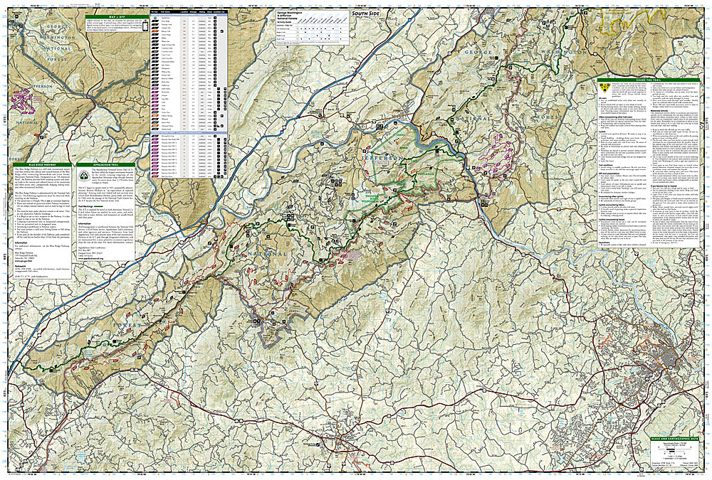
National Geographic Trails Illustrated Lexington & Blue Ridge Mountains Map #789 — waterproof, tear-resistant. Coverage of the George Washington National Forest near Lexington, the Blue Ridge Parkway corridor, James River Face Wilderness, and surrounding Virginia highlands. GPS-compatible.
The National Geographic Trails Illustrated Lexington & Blue Ridge Mountains Map covers the George Washington National Forest near Lexington, Virginia — the Blue Ridge Parkway corridor, James River Face Wilderness, Appalachian Trail crossings, and surrounding national forest lands. Hiking trails, scenic drives, wilderness boundaries, and GPS coordinates are mapped in detail.
Key specs
- SKU: NGTI789
- Map number: 789
- Coverage: Lexington & Blue Ridge Mountains area, George Washington National Forest, Virginia
- Material: Waterproof, tear-resistant paper
- Features: Trails, Blue Ridge Parkway, James River Face Wilderness, AT crossings, scenic drives, GPS coordinates
Why it works
The Blue Ridge Parkway corridor near Lexington offers some of the most scenic driving and hiking in Virginia, with the James River Face Wilderness providing rugged backcountry access just off the parkway. The AT's crossings of the Blue Ridge in this section require accurate trail detail for hikers. Waterproof construction survives the rain and humidity common in the Virginia highlands year-round.
Ideal for
Hikers, scenic drivers, and outdoor enthusiasts exploring the Blue Ridge Parkway, James River Face Wilderness, and George Washington National Forest near Lexington, Virginia. See also NGTI791 (Staunton & Shenandoah Valley) for adjacent coverage to the north.
Share