National Geographic
Ogden, Monte Cristo Range: Map #700
Ogden, Monte Cristo Range: Map #700
Couldn't load pickup availability
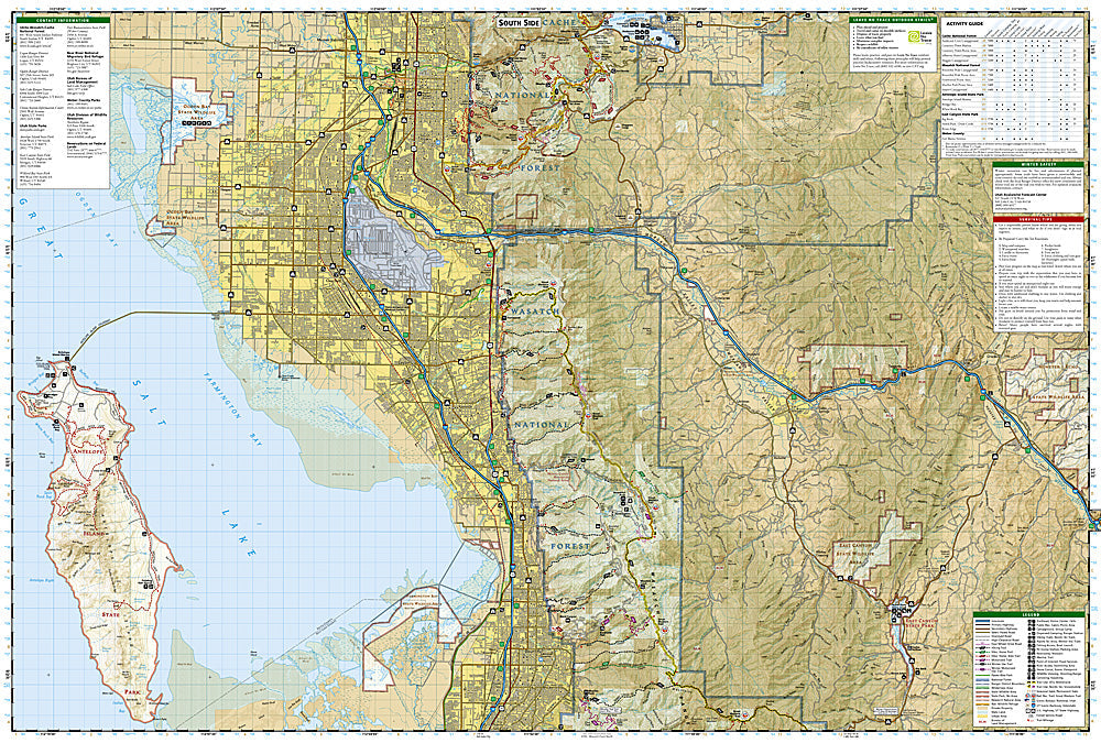
National Geographic Trails Illustrated Ogden & Monte Cristo Range Map #700 — waterproof, tear-resistant. Coverage of the Wasatch Range above Ogden, the Monte Cristo Range, and surrounding Wasatch-Cache National Forest in northern Utah. GPS-compatible.
The National Geographic Trails Illustrated Ogden & Monte Cristo Range Map covers the Wasatch Range above Ogden and the Monte Cristo Range in northern Utah — Snowbasin ski area, Ben Lomond Peak, the Monte Cristo area, and surrounding Wasatch-Cache National Forest. Hiking and mountain biking trails, ski terrain, campgrounds, trailheads, and GPS coordinates are mapped in detail.
Key specs
- SKU: NGTI700
- Map number: 700
- Coverage: Ogden & Monte Cristo Range, Wasatch-Cache National Forest, Utah
- Material: Waterproof, tear-resistant paper
- Features: Trails, Snowbasin, Ben Lomond Peak, Monte Cristo area, mountain biking routes, campgrounds, GPS coordinates
Why it works
The Wasatch Range above Ogden offers some of Utah's best accessible backcountry terrain, with Ben Lomond Peak's prominent summit and Snowbasin's extensive summer trail network providing significant recreation coverage. The Monte Cristo area's high-elevation terrain and the surrounding national forest's hunting and camping areas add value for a wide range of users. Waterproof construction survives the Wasatch Range's afternoon thunderstorms and the variable weather common in northern Utah's high country.
Ideal for
Hikers, mountain bikers, hunters, skiers, and outdoor enthusiasts exploring the Wasatch Range above Ogden and the Monte Cristo area in northern Utah. See also NGTI701 (Wasatch Front North) for adjacent coverage.
Share