National Geographic
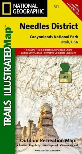
National Geographic Utah Canyonlands Needles District: Map #311
National Geographic Utah Canyonlands Needles District: Map #311
Couldn't load pickup availability
National Geographic Trails Illustrated topo map of Canyonlands Needles District — waterproof, tear-resistant, GPS-compatible.
National Geographic Trails Illustrated Map #311 covers the Needles District of Canyonlands National Park, Utah. Detailed topographic contours, trails, campsites, 4WD roads, and points of interest printed on waterproof, tear-resistant paper. GPS-compatible with UTM grid lines.
Key specs:
- Map number: #311
- Publisher: National Geographic Trails Illustrated
- Region: Canyonlands National Park — Needles District, Utah
- Material: Waterproof, tear-resistant paper
- GPS-compatible with UTM grid lines
- Coverage: Trails, campsites, 4WD roads, points of interest, and topographic contours
- Condition: Brand new
Why it works:
Trails Illustrated maps are the standard reference for national park navigation — more detailed and recreation-focused than standard USGS quads, printed on waterproof paper that survives rain, river crossings, and hard use. The Needles District is one of Canyonlands' most complex areas for navigation; this map covers every trail and route.
Ideal for: Hikers, backpackers, 4WD explorers, and canyoneers visiting the Needles District of Canyonlands National Park who need a durable, detailed trail map.
Share