National Geographic
Bryce Canyon National Park: Map #219
Bryce Canyon National Park: Map #219
Couldn't load pickup availability
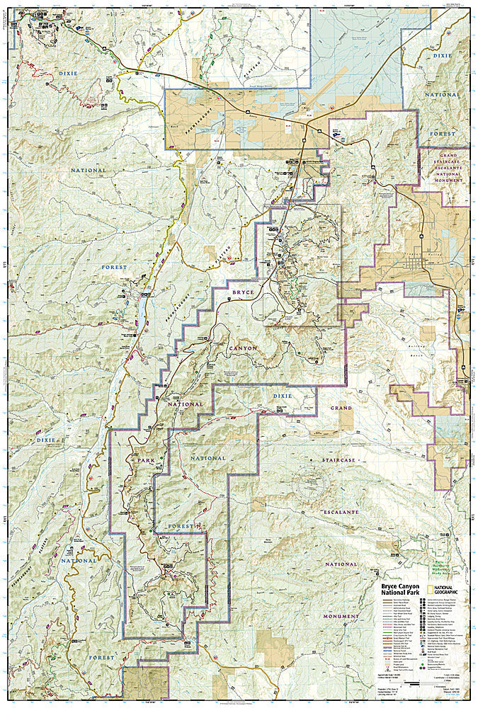
National Geographic Trails Illustrated Bryce Canyon National Park Map #219 — waterproof, tear-resistant. Complete coverage of Bryce Canyon National Park including the hoodoo amphitheaters, Rim Trail, Queens Garden, Navajo Loop, and surrounding park lands in Utah. GPS-compatible.
The National Geographic Trails Illustrated Bryce Canyon National Park Map provides complete coverage of the park — the hoodoo amphitheaters, Rim Trail, Queens Garden Trail, Navajo Loop, Fairyland Loop, and the full park road. Trails, viewpoints, campgrounds, shuttle stops, and GPS coordinates are mapped in detail.
Key specs
- SKU: NGTI219
- Map number: 219
- Coverage: Bryce Canyon National Park, Utah
- Material: Waterproof, tear-resistant paper
- Features: Full trail network, hoodoo amphitheaters, Rim Trail, viewpoints, shuttle stops, campgrounds, GPS coordinates
Why it works
Bryce Canyon's hoodoo amphitheaters and the dense trail network below the rim can be disorienting without a detailed map — the Queens Garden and Navajo Loop trails' junction complexity and the Fairyland Loop's length require accurate trail detail for navigation. The park's shuttle system and the viewpoint locations along the rim road require accurate stop detail for visitors without cars. Waterproof construction survives the high-altitude plateau's variable weather from summer thunderstorms to early-season snow.
Ideal for
Hikers, sightseers, and families exploring Bryce Canyon National Park's hoodoos, amphitheaters, and rim trails in Utah. See also NGTI705 (Paunsaugunt Plateau & Mount Dutton) for adjacent coverage beyond the park boundary.
Share