National Geographic
National Geographic Moab East & West Bundle
National Geographic Moab East & West Bundle
Couldn't load pickup availability
National Geographic Trails Illustrated Moab East & West Map Bundle — waterproof, tear-resistant, detailed topographic maps of the Moab area including Arches, Canyonlands, and surrounding BLM lands with trail networks for hiking, mountain biking, and off-roading. For mountain bikers, hikers, and desert explorers.
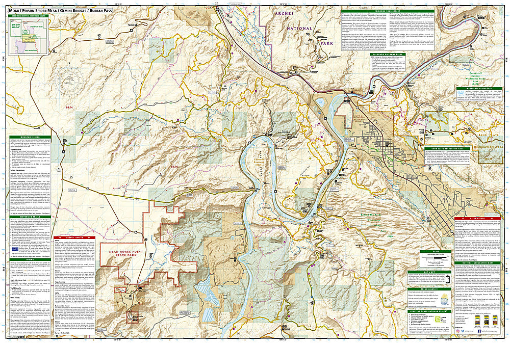
The National Geographic Moab East & West Map Bundle includes the Trails Illustrated Moab East and Moab West maps — together covering Arches National Park, Canyonlands National Park (Island in the Sky and Needles districts), and the surrounding BLM lands with their extensive trail networks. Detailed topography, mountain biking trails, hiking routes, off-road tracks, recreation sites, and campgrounds on waterproof, tear-resistant paper.
Key specs
- SKU: NGTIB010
- Coverage: Moab East and Moab West (Arches NP, Canyonlands NP, surrounding BLM lands)
- Material: Waterproof, tear-resistant paper
- Features: Mountain biking trails, hiking routes, off-road tracks, national park coverage, campgrounds
- Format: 2-map bundle (East + West)
Why it works
Moab's trail network spans both sides of the Colorado River, with Arches and the Island in the Sky district to the east and the Needles district and BLM mountain biking trails to the west — a bundle covering both sides provides complete coverage of the Moab area without gaps. The East/West split at the Colorado River is the natural division for Moab's trail systems, making this the most logical bundle for comprehensive coverage. Waterproof construction survives the desert heat and the occasional flash flood common in canyon country.
Ideal for
Mountain bikers, hikers, off-roaders, and desert explorers visiting the Moab area's national parks and BLM lands. See also NGTIB307 (Moab Area Map Pack Bundle) for additional coverage options.
Share