National Geographic
Grand Staircase, Paunsaugunt: Map #714
Grand Staircase, Paunsaugunt: Map #714
Couldn't load pickup availability
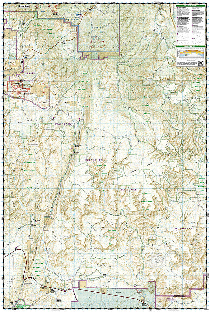
National Geographic Trails Illustrated Grand Staircase & Paunsaugunt Map #714 — waterproof, tear-resistant. Coverage of the Grand Staircase section of Grand Staircase-Escalante National Monument, the Paunsaugunt Plateau, and surrounding canyon and plateau terrain in southern Utah. GPS-compatible.
The National Geographic Trails Illustrated Grand Staircase & Paunsaugunt Map covers the Grand Staircase section of Grand Staircase-Escalante National Monument and the Paunsaugunt Plateau — the colorful Vermilion Cliffs, White Cliffs, and Gray Cliffs of the Grand Staircase, OHV routes, hiking trails, and surrounding plateau terrain. Trails, OHV routes, geological features, campgrounds, and GPS coordinates are mapped in detail.
Key specs
- SKU: NGTI714
- Map number: 714
- Coverage: Grand Staircase & Paunsaugunt area, Grand Staircase-Escalante NM, Utah
- Material: Waterproof, tear-resistant paper
- Features: Trails, Grand Staircase geological features, OHV routes, Paunsaugunt Plateau, campgrounds, GPS coordinates
Why it works
The Grand Staircase's sequence of colorful cliff bands — Vermilion, White, and Gray — creates a complex geological landscape that requires detailed topographic mapping to navigate safely. The monument's vast size and the lack of maintained trails in many areas make accurate OHV route and access point mapping essential for visitors. Waterproof construction survives the southern Utah desert's variable weather from summer monsoons to early-season snow on the plateau.
Ideal for
Hikers, geologists, OHV riders, and explorers visiting the Grand Staircase section of Grand Staircase-Escalante National Monument in southern Utah. See also NGTI710 (Canyons of the Escalante) for the Escalante River canyon coverage.
Share