National Geographic
Canyonlands, Island in the Sky: Map #310
Canyonlands, Island in the Sky: Map #310
Couldn't load pickup availability
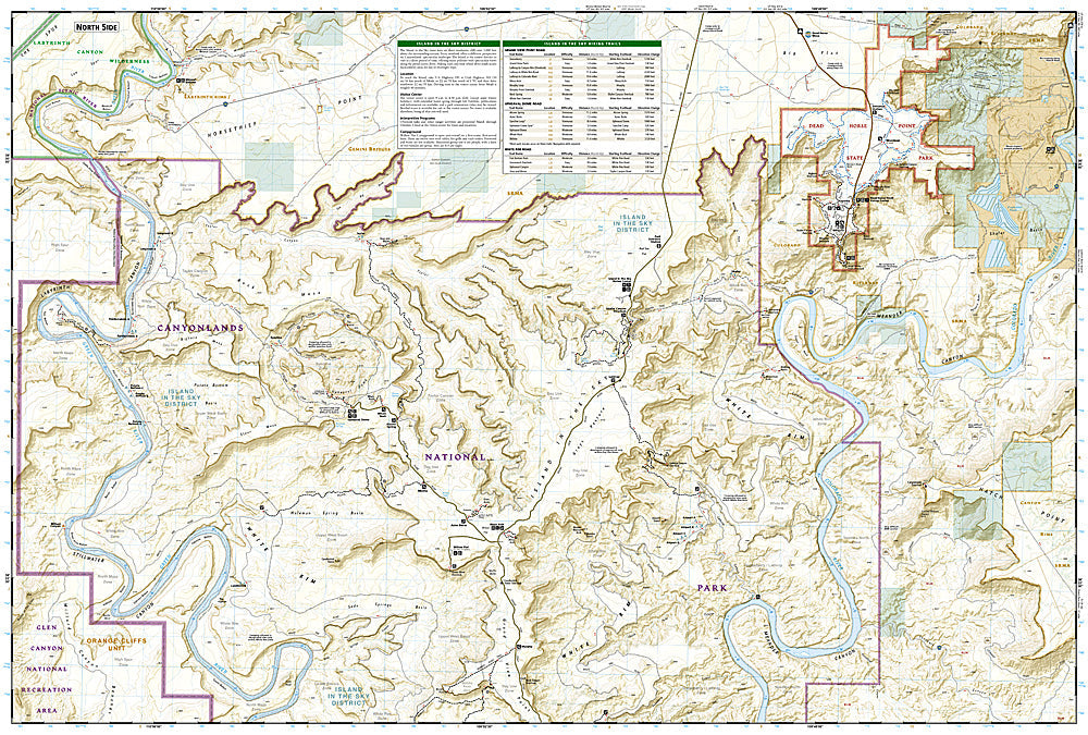
National Geographic Trails Illustrated Canyonlands Island in the Sky Map #310 — waterproof, tear-resistant. Coverage of Canyonlands National Park's Island in the Sky district including the White Rim Road, mesa rim trails, and surrounding canyon country near Moab, Utah. GPS-compatible.
The National Geographic Trails Illustrated Canyonlands Island in the Sky Map covers the Island in the Sky district of Canyonlands National Park — the White Rim Road (100-mile 4WD/mountain bike route), mesa rim trails, Upheaval Dome, Grand View Point, and surrounding canyon country. Trails, 4WD routes, overlooks, campgrounds, and GPS coordinates are mapped in detail.
Key specs
- SKU: NGTI310
- Map number: 310
- Coverage: Canyonlands NP Island in the Sky district, Utah
- Material: Waterproof, tear-resistant paper
- Features: White Rim Road, rim trails, Upheaval Dome, overlooks, campgrounds, GPS coordinates
Why it works
The White Rim Road is one of the premier 4WD and mountain biking routes in the American Southwest, requiring a permit and detailed route mapping for the multi-day trip around the Island in the Sky mesa. The rim trails and overlooks require accurate trail detail for navigation on the mesa top. Waterproof construction survives the desert heat and the occasional rain that can make the White Rim's clay sections impassable.
Ideal for
4WD enthusiasts, mountain bikers, hikers, and photographers exploring Canyonlands National Park's Island in the Sky district near Moab. See also NGTI703 (Manti-La Sal NF) for the La Sal Mountains visible from the rim.
Share