National Geographic
Glen Canyon National Recreation Area: Map #213
Glen Canyon National Recreation Area: Map #213
Couldn't load pickup availability
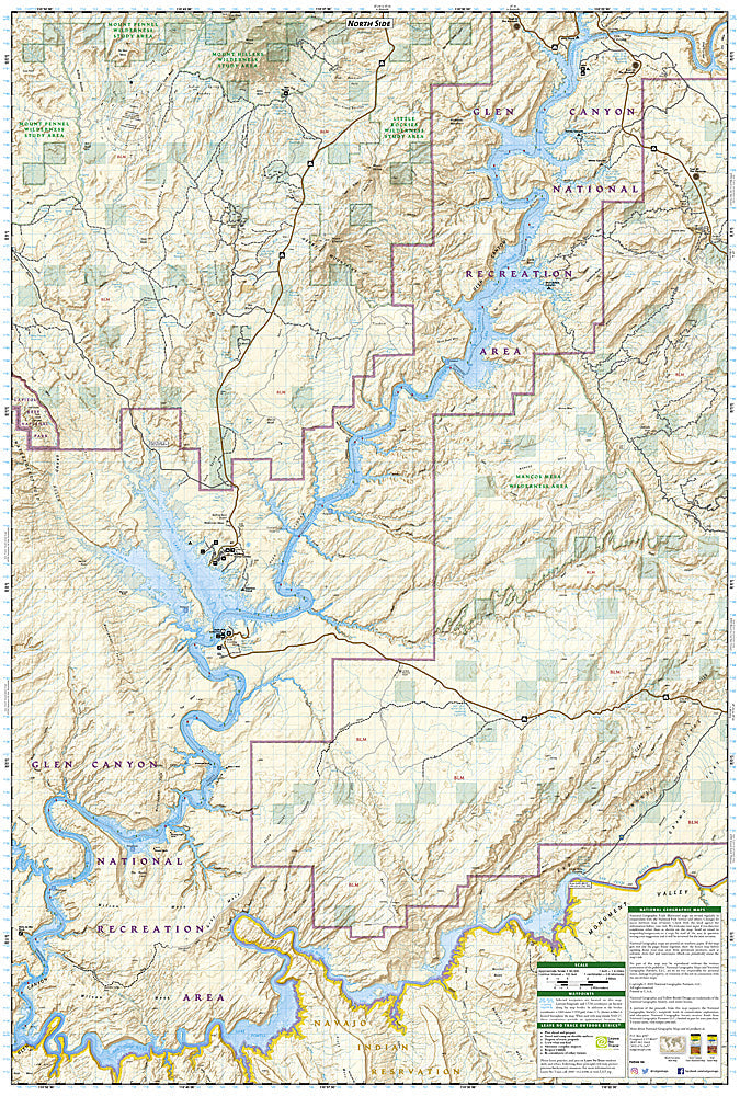
National Geographic Trails Illustrated Glen Canyon National Recreation Area Map #213 — waterproof, tear-resistant. Coverage of Glen Canyon NRA including Lake Powell, the Escalante River canyons, Rainbow Bridge, and surrounding canyon country in Utah and Arizona. GPS-compatible.
The National Geographic Trails Illustrated Glen Canyon National Recreation Area Map covers the full recreation area — Lake Powell's 1,960 miles of shoreline, Rainbow Bridge National Monument, the Escalante River canyon access, marinas, and surrounding canyon country. Boating routes, marina locations, hiking access, and GPS coordinates are mapped in detail.
Key specs
- SKU: NGTI213
- Map number: 213
- Coverage: Glen Canyon National Recreation Area (Lake Powell), Utah & Arizona
- Material: Waterproof, tear-resistant paper
- Features: Lake Powell shoreline, marinas, Rainbow Bridge, Escalante canyon access, boating routes, GPS coordinates
Why it works
Lake Powell's 1,960 miles of shoreline and the maze of side canyons make navigation by boat extremely challenging without a detailed map — marina locations, fuel stops, and canyon access points are essential for planning multi-day houseboat and motorboat trips. Rainbow Bridge is accessible only by boat or a long overland hike, making accurate route detail critical. Waterproof construction is essential in a water-based recreation area where maps are constantly exposed to lake spray and splashing.
Ideal for
Boaters, houseboaters, hikers, and canyoneers exploring Lake Powell and Glen Canyon National Recreation Area in Utah and Arizona. See also NGTI710 (Canyons of the Escalante) for detailed coverage of the Escalante canyon system.
Share