National Geographic
Mount Hood Wilderness: Map #321
Mount Hood Wilderness: Map #321
Couldn't load pickup availability
National Geographic Trails Illustrated Mount Hood Wilderness Map #321 — waterproof, tear-resistant. Coverage of the Mount Hood Wilderness, Timberline Trail, climbing routes, and surrounding Mount Hood National Forest in Oregon. GPS-compatible.
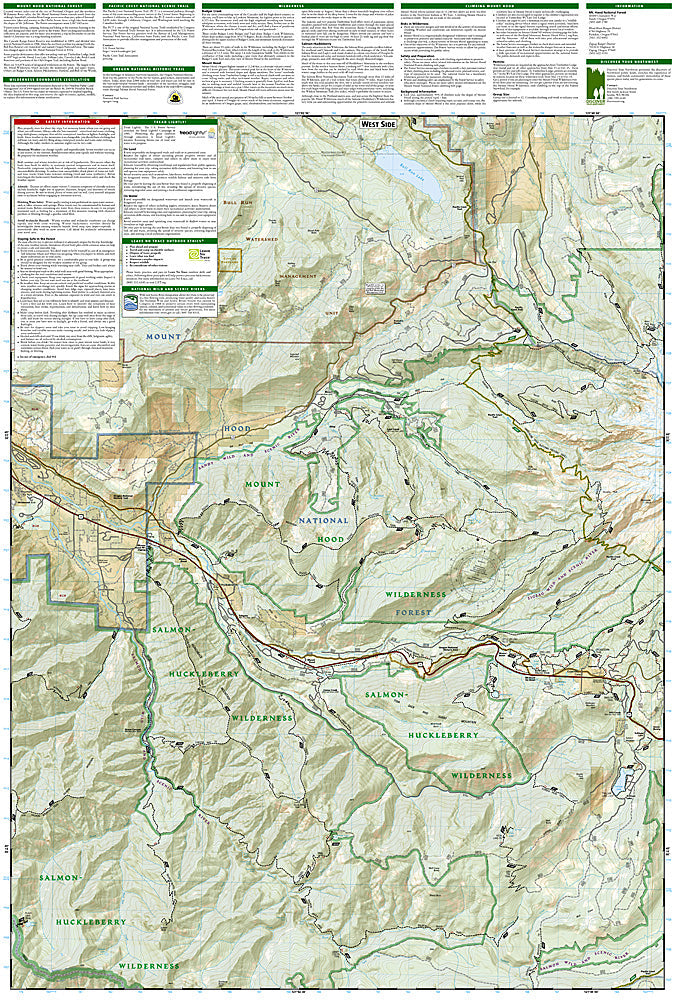
The National Geographic Trails Illustrated Mount Hood Wilderness Map covers the Mount Hood Wilderness and surrounding Mount Hood National Forest — the Timberline Trail (93-mile circumnavigation of the volcano), climbing routes on Oregon's highest peak (11,249 ft), Timberline Lodge, and surrounding wilderness terrain. Trails, Timberline Trail route, climbing routes, wilderness boundaries, and GPS coordinates are mapped in detail.
Key specs
- SKU: NGTI321
- Map number: 321
- Coverage: Mount Hood Wilderness, Mount Hood National Forest, Oregon
- Material: Waterproof, tear-resistant paper
- Features: Timberline Trail, climbing routes, wilderness boundaries, Timberline Lodge, GPS coordinates
Why it works
Mount Hood is the most climbed glaciated peak in North America, with the South Side route seeing thousands of climbers per year — accurate climbing route and crevasse zone mapping is essential for safe ascents on the mountain's glaciated terrain. The Timberline Trail's 93-mile circumnavigation requires detailed campsite and water source mapping for multi-day trips. Waterproof construction survives the Pacific Northwest's frequent rain and the glacier environment on Mount Hood's upper slopes.
Ideal for
Climbers, backpackers, and hikers exploring Mount Hood Wilderness's Timberline Trail and climbing routes in Oregon. See also NGTI820 (Mount Hood National Forest) for broader national forest coverage.
Share