National Geographic
Columbia River Gorge National Area: Map #821
Columbia River Gorge National Area: Map #821
Couldn't load pickup availability
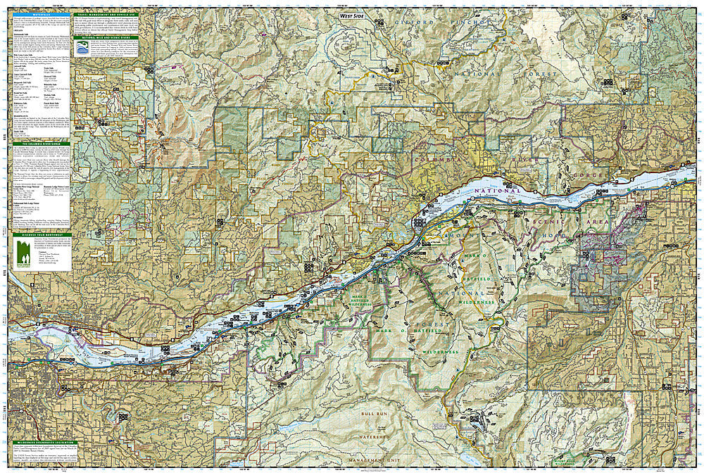
National Geographic Trails Illustrated Columbia River Gorge National Scenic Area Map #821 — waterproof, tear-resistant. Coverage of the Columbia River Gorge National Scenic Area including waterfalls, hiking trails, and the Historic Columbia River Highway in Oregon and Washington. GPS-compatible.
The National Geographic Trails Illustrated Columbia River Gorge National Scenic Area Map covers the full gorge on both the Oregon and Washington sides — Multnomah Falls, the Historic Columbia River Highway, the Gorge Trail, Beacon Rock, and surrounding national scenic area lands. Trails, waterfall access, scenic viewpoints, trailheads, and GPS coordinates are mapped in detail.
Key specs
- SKU: NGTI821
- Map number: 821
- Coverage: Columbia River Gorge National Scenic Area, Oregon and Washington
- Material: Waterproof, tear-resistant paper
- Features: Trails, Multnomah Falls, Historic Columbia River Highway, Gorge Trail, scenic viewpoints, GPS coordinates
Why it works
The Columbia River Gorge's dense concentration of waterfalls, viewpoints, and trails on both sides of the river requires a map covering both the Oregon and Washington shores to plan efficient day hikes and point-to-point routes. The Gorge Trail's 36-mile route along the Oregon side requires detailed trailhead and access point mapping. Waterproof construction survives the gorge's frequent rain and the wind that is a constant feature of the Columbia River corridor.
Ideal for
Hikers, cyclists, and outdoor enthusiasts exploring the Columbia River Gorge's waterfalls, trails, and scenic viewpoints. See also NGTIB031 (Mount Hood & Columbia River Gorge Bundle) for combined coverage with Mount Hood.
Share