National Geographic
Mount Hood National Forest: Map #820
Mount Hood National Forest: Map #820
Couldn't load pickup availability
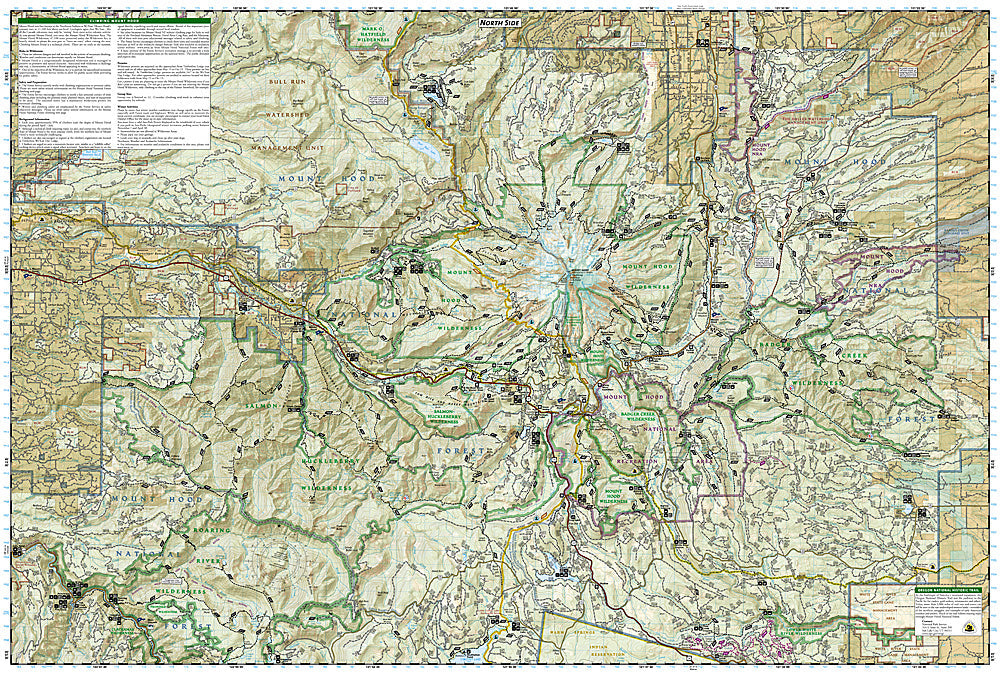
National Geographic Trails Illustrated Mount Hood National Forest Map #820 — waterproof, tear-resistant. Coverage of Mount Hood National Forest including the Mount Hood Wilderness, Timberline Trail, climbing routes, ski areas, and surrounding forest lands in Oregon. GPS-compatible.
The National Geographic Trails Illustrated Mount Hood National Forest Map covers the full national forest — the Mount Hood Wilderness, the 40-mile Timberline Trail circumnavigating the mountain, all major climbing routes, Timberline Lodge, ski areas, and surrounding forest trails. Trails, climbing routes, campgrounds, trailheads, and GPS coordinates are mapped in detail.
Key specs
- SKU: NGTI820
- Map number: 820
- Coverage: Mount Hood National Forest, Oregon
- Material: Waterproof, tear-resistant paper
- Features: Timberline Trail, climbing routes, ski areas, wilderness boundaries, campgrounds, GPS coordinates
Why it works
Mount Hood is the most climbed glaciated peak in North America and Oregon's highest point — accurate glacier approach and route detail is essential for the thousands of climbers who attempt the South Side route each year. The Timberline Trail's 40-mile loop requires detailed campsite and water source mapping for planning the multi-day circumnavigation. Waterproof construction survives the Pacific Northwest's frequent rain and the glacier travel that exposes maps to constant moisture.
Ideal for
Mountaineers, Timberline Trail hikers, backpackers, and skiers exploring Mount Hood National Forest. See also NGTIB031 (Mount Hood & Columbia River Gorge Bundle) for combined coverage with the Columbia River Gorge.
Share