National Geographic
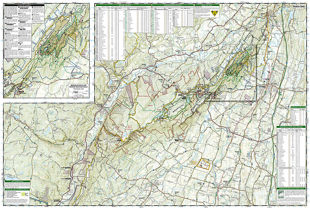
Shawangunk Mountains: Map #750
Shawangunk Mountains: Map #750
Couldn't load pickup availability
National Geographic Trails Illustrated Shawangunk Mountains Map #750 — waterproof, tear-resistant. Coverage of the Shawangunk Ridge including Minnewaska State Park Preserve, Mohonk Preserve, and surrounding Hudson Valley recreation areas in New York. GPS-compatible.
The National Geographic Trails Illustrated Shawangunk Mountains Map covers the Shawangunk Ridge in New York's Hudson Valley — Minnewaska State Park Preserve, Mohonk Preserve, Sam's Point Preserve, and the surrounding carriage road and trail network. Hiking trails, carriage roads, climbing areas, trailheads, and GPS coordinates are mapped in detail.
Key specs
- SKU: NGTI750
- Map number: 750
- Coverage: Shawangunk Mountains, New York (Hudson Valley)
- Material: Waterproof, tear-resistant paper
- Features: Trails, carriage roads, Minnewaska & Mohonk Preserves, climbing areas, GPS coordinates
Why it works
The Shawangunks are one of the premier rock climbing destinations in the eastern US, with the Trapps and Near Trapps cliffs attracting climbers from across the region — accurate approach trail and cliff location detail is essential for climbers navigating the preserve's access rules. The carriage road network at Mohonk and Minnewaska offers unique non-motorized recreation that requires detailed mapping to navigate efficiently. Waterproof construction survives the Hudson Valley's frequent rain and the variable weather common on the exposed ridge.
Ideal for
Hikers, rock climbers, cyclists, and outdoor enthusiasts exploring the Shawangunk Mountains' preserves and carriage roads in New York's Hudson Valley. See also NGTI755 (Catskill Park) for adjacent coverage to the north.
Share