National Geographic
Adirondack Park, Lake Placid: Map #742
Adirondack Park, Lake Placid: Map #742
Couldn't load pickup availability
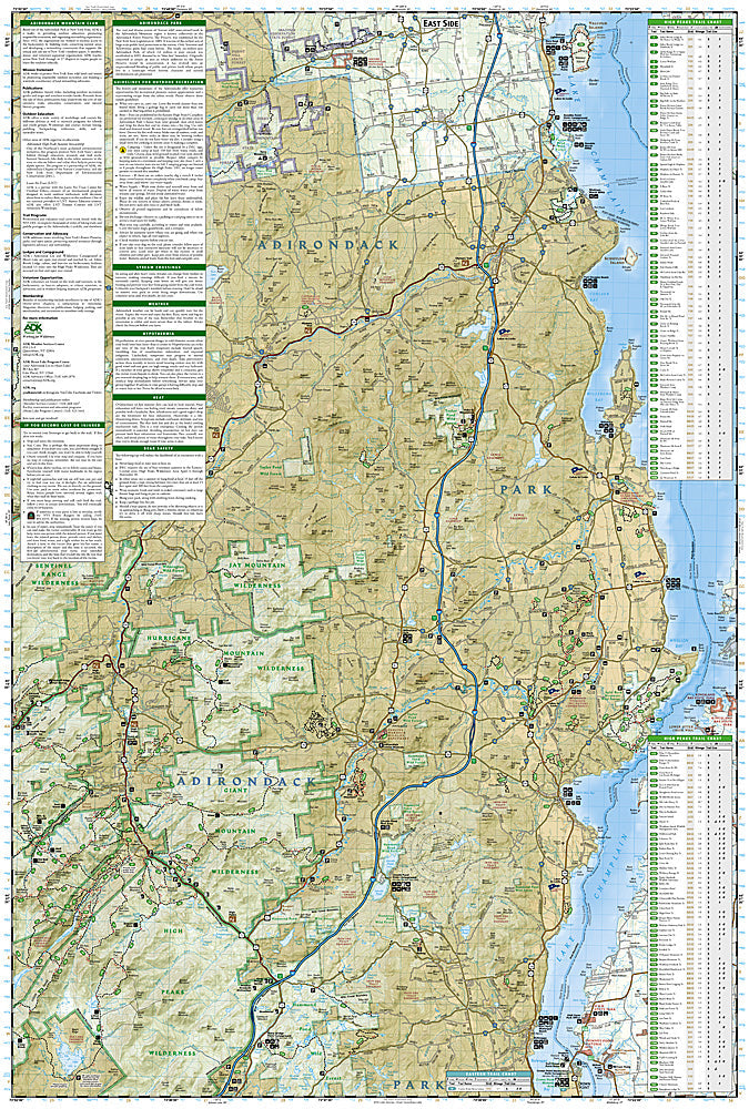
National Geographic Trails Illustrated Adirondack Park Lake Placid Map #742 — waterproof, tear-resistant, scale 1:75,000. Coverage of the High Peaks Wilderness, Lake Placid, Whiteface Mountain, and surrounding Adirondack Park terrain in New York. GPS-compatible.
The National Geographic Trails Illustrated Adirondack Park Lake Placid Map covers the High Peaks Wilderness and Lake Placid area — the 46 Adirondack High Peaks including Mount Marcy (New York's highest point), the Adirondack Loj, Heart Lake, Whiteface Mountain, and surrounding wilderness terrain. Trails, High Peaks routes, lean-tos, wilderness boundaries, and GPS coordinates are mapped in detail.
Key specs
- SKU: NGTI742
- Map number: 742
- Scale: 1:75,000
- Coverage: Adirondack Park High Peaks & Lake Placid area, New York
- Material: Waterproof, tear-resistant paper
- Features: Trails, 46 High Peaks routes, Mount Marcy, lean-tos, wilderness boundaries, GPS coordinates
Why it works
The Adirondack High Peaks are one of the most popular peak-bagging challenges in the eastern US, with the 46er tradition drawing hikers to all 46 peaks above 4,000 feet — accurate trail and summit route detail is essential for navigating the complex High Peaks trail network. The area's lean-to reservation system and the wilderness's permit requirements make accurate shelter location mapping important for planning overnight trips. Waterproof construction survives the Adirondacks' frequent rain and the variable weather common on the High Peaks' exposed summits.
Ideal for
Hikers, peak baggers, backpackers, and Adirondack 46er aspirants exploring the High Peaks Wilderness and Lake Placid area. See also NGTI743 (Lake Placid & High Peaks) for additional coverage.
Share