National Geographic
Santa Fe, Truchas Peak: Map #731
Santa Fe, Truchas Peak: Map #731
Couldn't load pickup availability
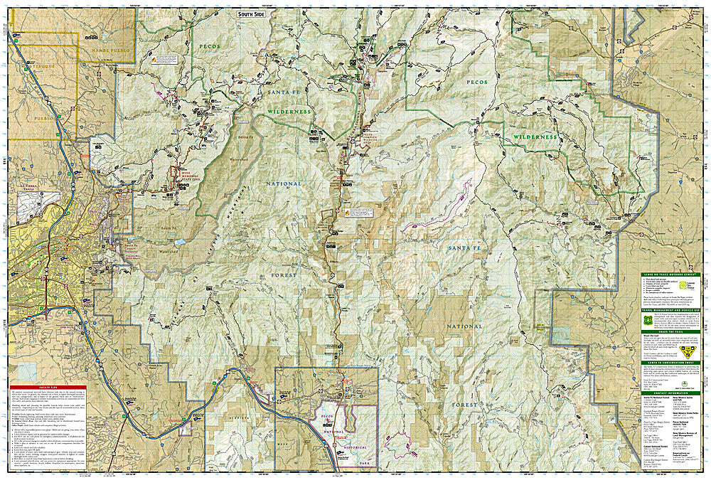
National Geographic Trails Illustrated Santa Fe & Truchas Peak Map #731 — waterproof, tear-resistant. Coverage of the Pecos Wilderness, Truchas Peaks, and surrounding Santa Fe National Forest near Santa Fe, New Mexico. GPS-compatible.
The National Geographic Trails Illustrated Santa Fe & Truchas Peak Map covers the Pecos Wilderness and surrounding Santa Fe National Forest — the Truchas Peaks (New Mexico's second highest summit group), the Pecos River headwaters, alpine lakes, and surrounding wilderness terrain. Hiking and equestrian trails, wilderness boundaries, alpine lakes, trailheads, and GPS coordinates are mapped in detail.
Key specs
- SKU: NGTI731
- Map number: 731
- Coverage: Pecos Wilderness & Truchas Peak area, Santa Fe National Forest, New Mexico
- Material: Waterproof, tear-resistant paper
- Features: Trails, Pecos Wilderness, Truchas Peaks, Pecos River headwaters, alpine lakes, GPS coordinates
Why it works
The Pecos Wilderness is the most popular wilderness area in New Mexico, with the Truchas Peaks and the Pecos River headwaters attracting hikers, backpackers, and anglers from Santa Fe and Albuquerque. The wilderness's complex trail network and the technical terrain on the Truchas Peaks require detailed topographic mapping for safe navigation. Waterproof construction survives New Mexico's monsoon season thunderstorms and the variable weather common in the Sangre de Cristo Mountains.
Ideal for
Hikers, backpackers, equestrians, and anglers exploring the Pecos Wilderness and Truchas Peaks near Santa Fe, New Mexico. See also NGTI730 (Taos, Wheeler Peak) for adjacent coverage to the north.
Share